
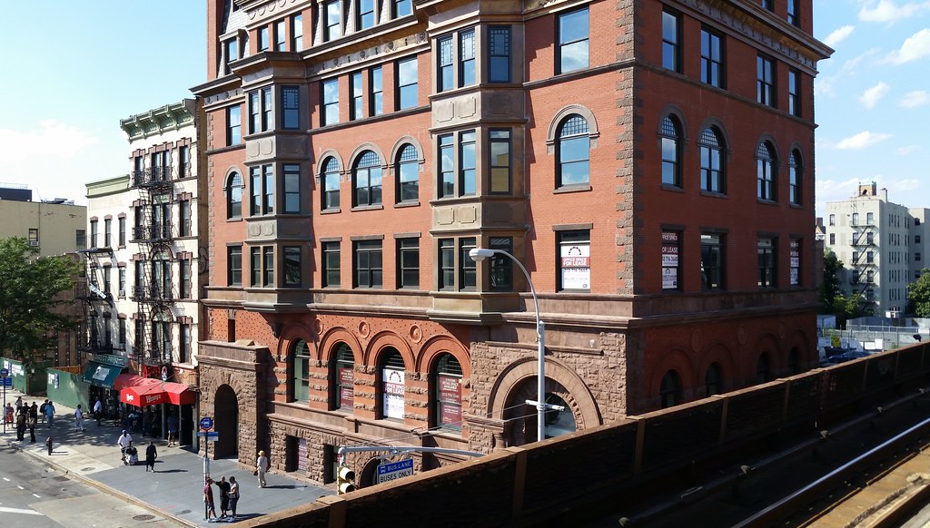
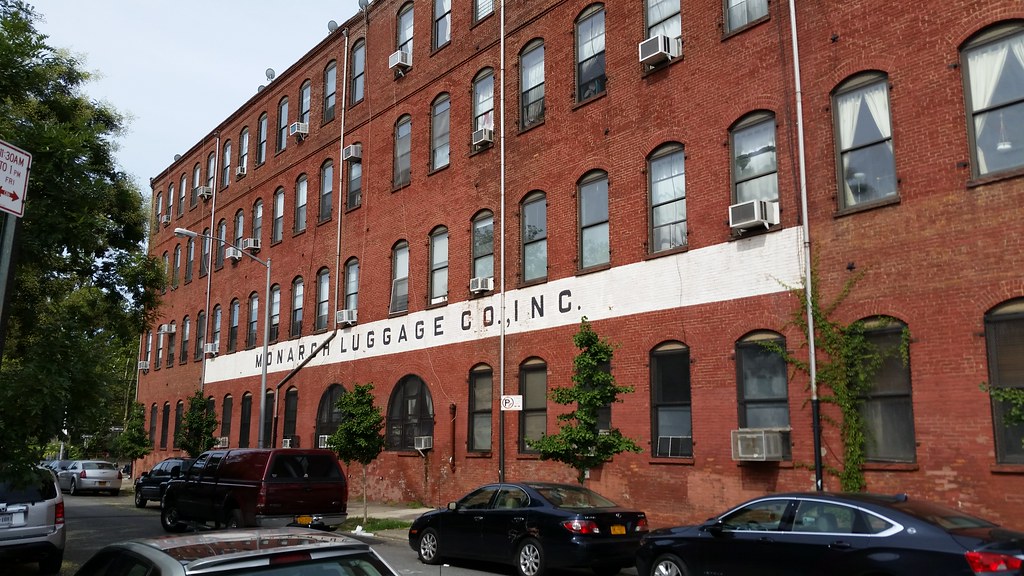
Stepping off a Metro-North train in Harlem, I see that a reasonable approximation of the old Corn Exchange Bank has risen atop the ruins of the original building.
You can see a wider shot of the building in Street View. And here's what the place looked like in 1932.
From the building's 1994 landmark designation report:
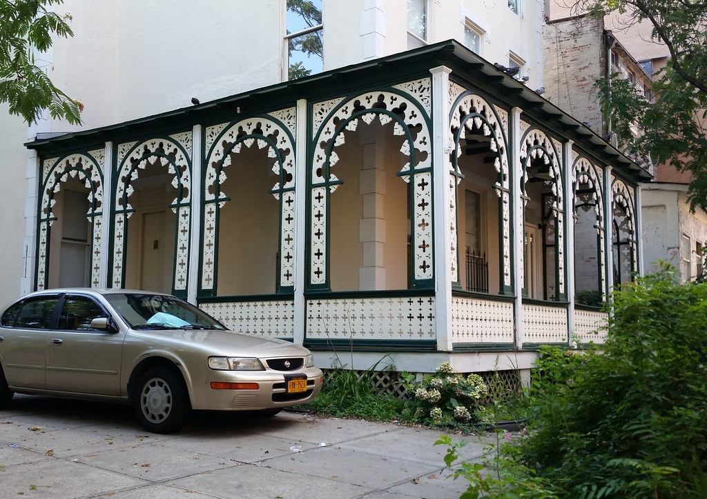
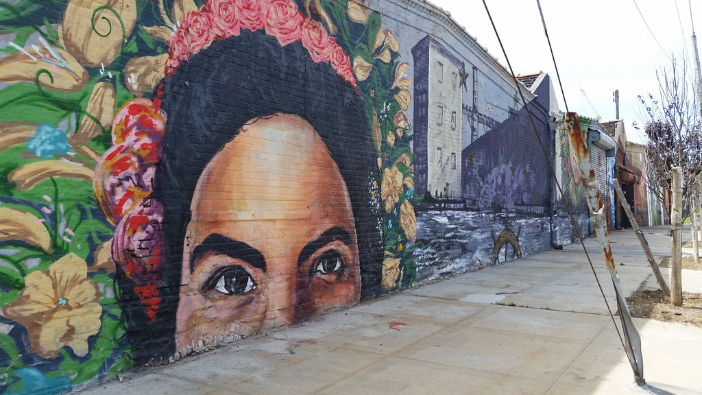
The house at 12 West 129th Street, erected c.1863 when the village of Harlem was undergoing development as a suburban center, stands as a rare survivor of Harlem's early history, prior to its rapid development as an urban neighborhood. Built for two carpenters, William Paul and Thomas Wilson, and their families, it was a two-and-a-half story frame structure characteristic of suburban architecture. Subsequent changes to the house reflect adaptations by new owners to their needs, as well as changes in the surrounding community. In 1883, piano merchant John Bolton Simpson, Jr., added the distinctive Moorish-inspired porch, the most significant architectural feature of the house, with its perforated ornamentation created by the use of a scroll saw. In 1896, the house was acquired by an order of Franciscan nuns which was expanding its mission in the greater New York area. In order to accommodate a new use as a convent and children's home, the building was enlarged to a full three stories. Since that time, the building has continued in institutional ownership; it was purchased in 1979 by the Christ Temple Church of the Apostolic Faith, which plans to convert it to a senior citizens' residence.I'm not sure what's currently happening with the building, but I do know it was used as a hostel called "Jazz on the Villa" for a few years around 2006 to 2009.
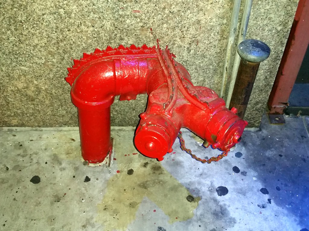
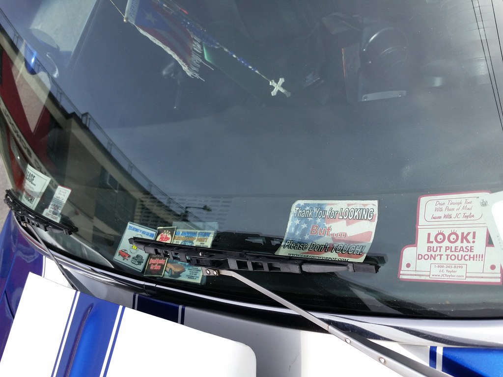
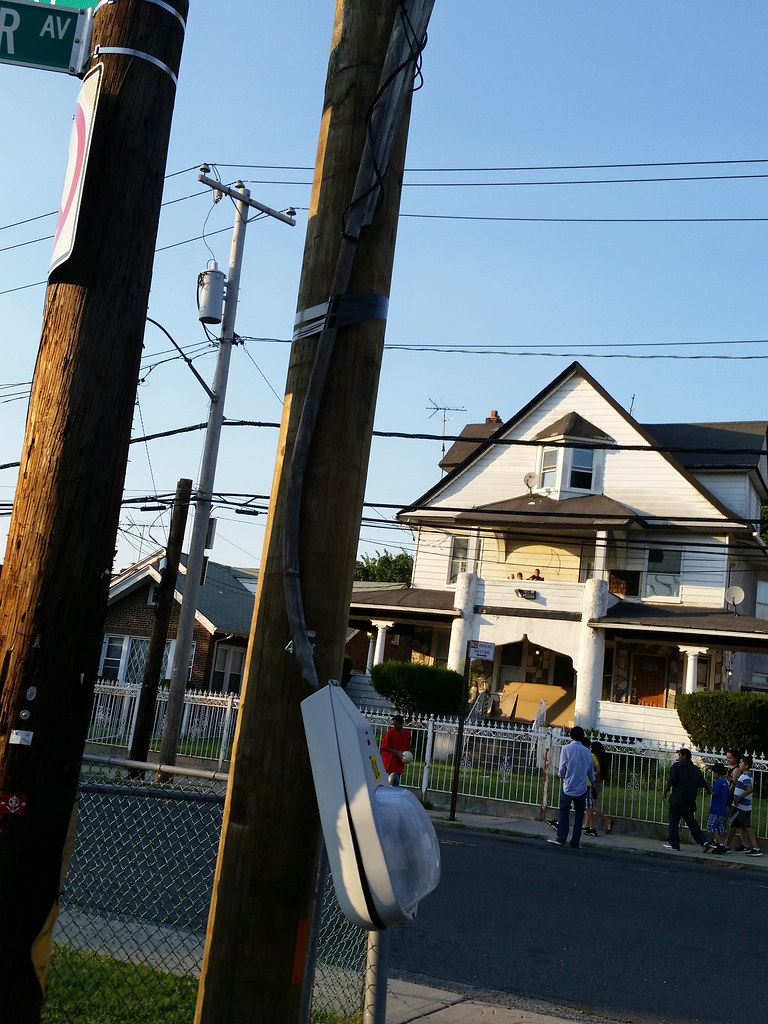
This stegosaurus of a standpipe connection is just one of the many tushie terrorizers conspiring to make the city's streets inhospitable to the weary keisters of pooped-out pedestrians. The sprinkler connection outside this building, pictured below, is equally unwelcoming.
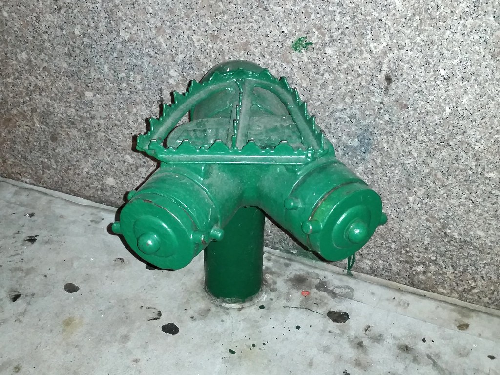
But don't despair. While this callous indifference to the suffering of others may be on the rise, there are still plenty of other Siamese connections that continue to welcome the tired, the poor, and the huddled asses of the world with open arms (a.k.a. spikeless sitting surfaces). Just around the corner, in fact, I found one providing refuge for run-down rumps in three different Street View photos — a sanctuary sitty, if you will.
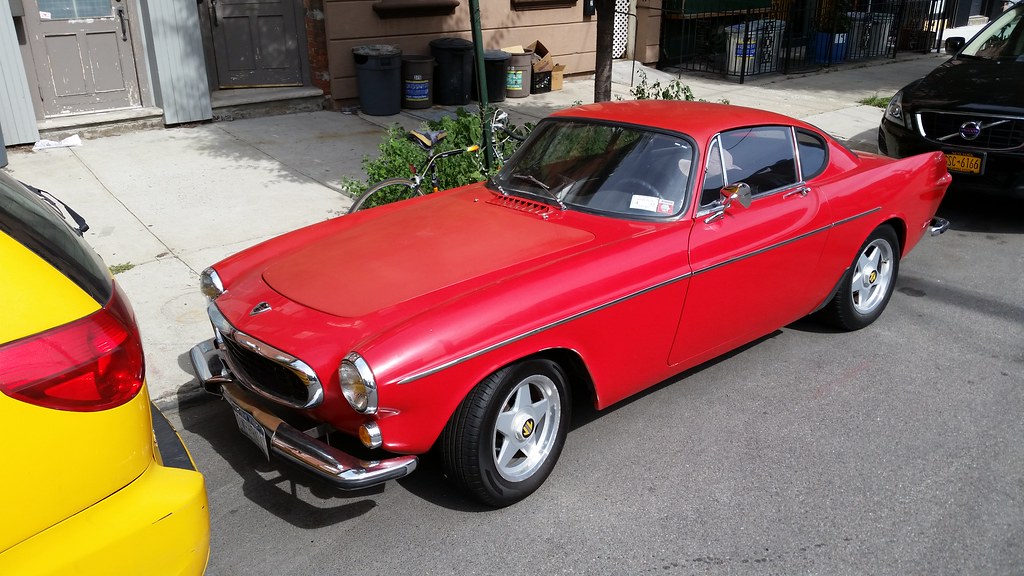
Irv Gordon, a retired science teacher from Long Island, has put a world-record 3 million miles and counting on his red 1966 Volvo 1800S (not pictured).
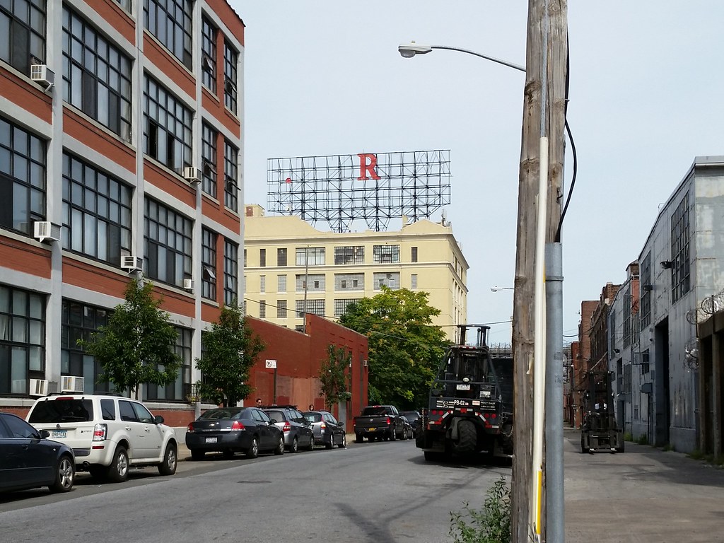
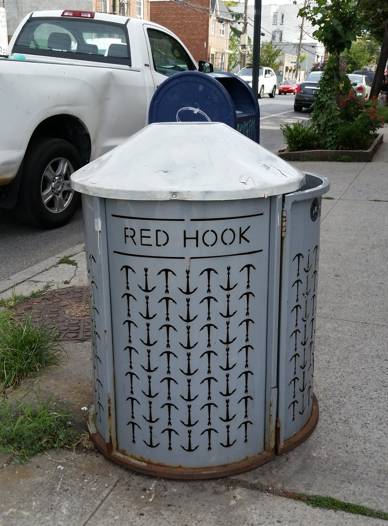
Since before I was born, a big red R has loomed mysteriously over the streets of Red Hook, leaving decades of perplexed passersby to wonder why such a prominent sign would be used to display such a nonsensical message.
There was a time, many years ago, when the R was just one of several 30-foot-tall letters perched atop that cream-colored building. In those days, the sign read "E.J. TRUM", the name of the paper box manufacturer that owned the place.
After John Turano & Sons, a furniture wholesaler, acquired the building in 1978, the Turanos wanted to put their own name up on the sign. But as Frank Turano told New York magazine in 2001:
We went on the roof and started pulling down these giant letters. The E, the J, the T. But the R got stuck. We couldn't move it. Someone almost fell off the building trying. It put a scare into us. It seemed better to leave it up there. It's been like that for 22 years. Recently a lot of people looking for billboards have come around asking about the space. But we'll leave it like that: just R.The Turanos have since moved on, but the R remains. (The period after the E is still stuck up there as well, of course, but it never seems to get much attention.) Of the four old neon rooftop signs that stood in the industrial Gowanus-Red Hook area when I started this walk, the R is one of only two left. Bruno Truck Sales is its fellow survivor, while Eagle Clothes and Kentile Floors have been torn down. (There is some talk of Eagle Clothes possibly being resurrected, however.)
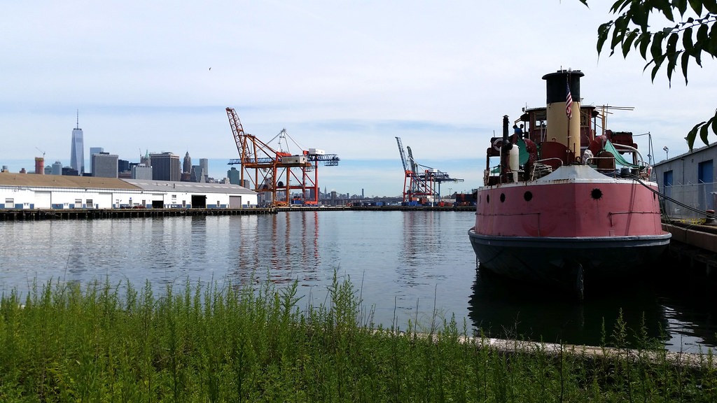
Gazing out across the Atlantic Basin, we get a good look at the Lower Manhattan skyline and the cranes of the Red Hook Container Terminal.
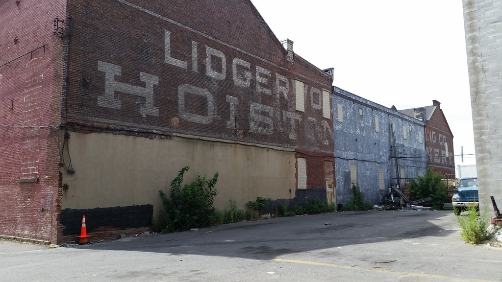
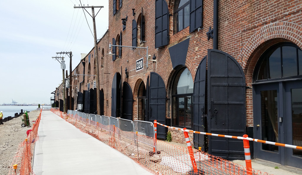
This is the northwestern facade of the old Lidgerwood Manufacturing Company factory complex. A major builder of cableways and hoisting machinery, Lidgerwood supplied cableways for the construction of the Panama Canal, the Hoover Dam, and many other large infrastructure projects. The company was founded in Brooklyn in 1873 and lives on today as the Superior-Lidgerwood-Mundy Corporation of Superior, Wisconsin.
The Brooklyn Edison electric company purchased this property from Lidgerwood in 1926, and by 1937 had painted over this wall (which at that time was fully visible from the harbor) with a big "COOK ELECTRICALLY" ad featuring Reddy Kilowatt. If you look closely (zoom in), you can still make out faint traces of the word "COOK" on the left side of the wall, on top of the older Lidgerwood lettering.
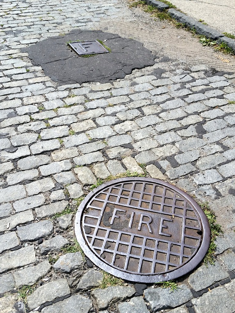
I'd never seen a manhole cover labeled "FIRE" before, but there are at least three in the immediate vicinity of the former Lidgerwood factory in Red Hook. As this 1916 map shows (look for the 12-inch high pressure line on Dikeman Street between Ferris Street and the water), the manholes are remnants of an old network of high-pressure water mains and hydrants installed in the early 1900s to improve firefighting capabilities in and around Downtown Brooklyn. Similar systems were also built in Coney Island and Manhattan.
Pumper trucks eventually eliminated the need for the high-pressure hydrants, which spent their last couple of decades operating like standard hydrants before being taken out of service altogether around 1980. Even though they were just useless relics from that point on, the city continued issuing tickets to vehicles parked in front of them.
Finally, in the mid-1990s, the city began getting rid of the old high-pressure hydrants. The associated manhole covers were removed as well, which explains why I've never noticed one before. I imagine the cover pictured above and the neighboring one — as well as the F handhole cover pictured above — were left in place because the block they're on is now a private street. (I don't know why the third, newer-looking FIRE cover a block away on Coffey Street wouldn't have been removed, however.)
You can check out the entire block-long painting in Street View.
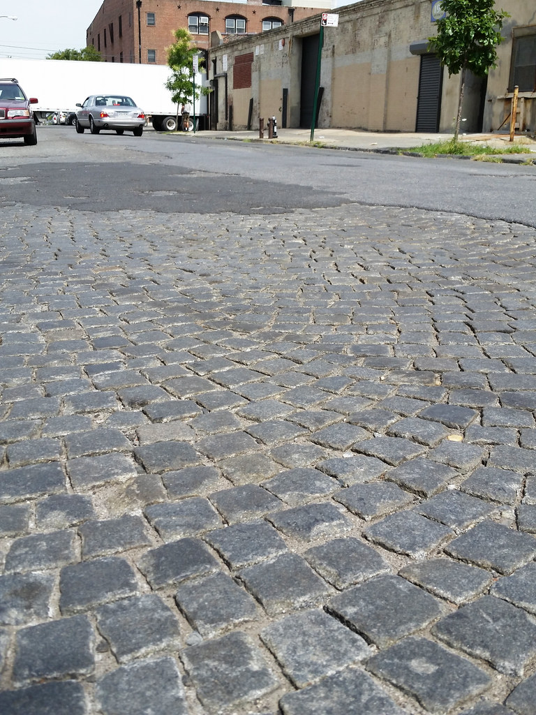
Old, exposed Belgian block pavement is a fairly common sight in this part of western Red Hook. The stones are usually laid out simply in straight lines, but a more elaborate pattern of intersecting arcs (seen much more clearly in Street View) can be found here on Van Dyke Street. This is apparently known as a bogen layout.
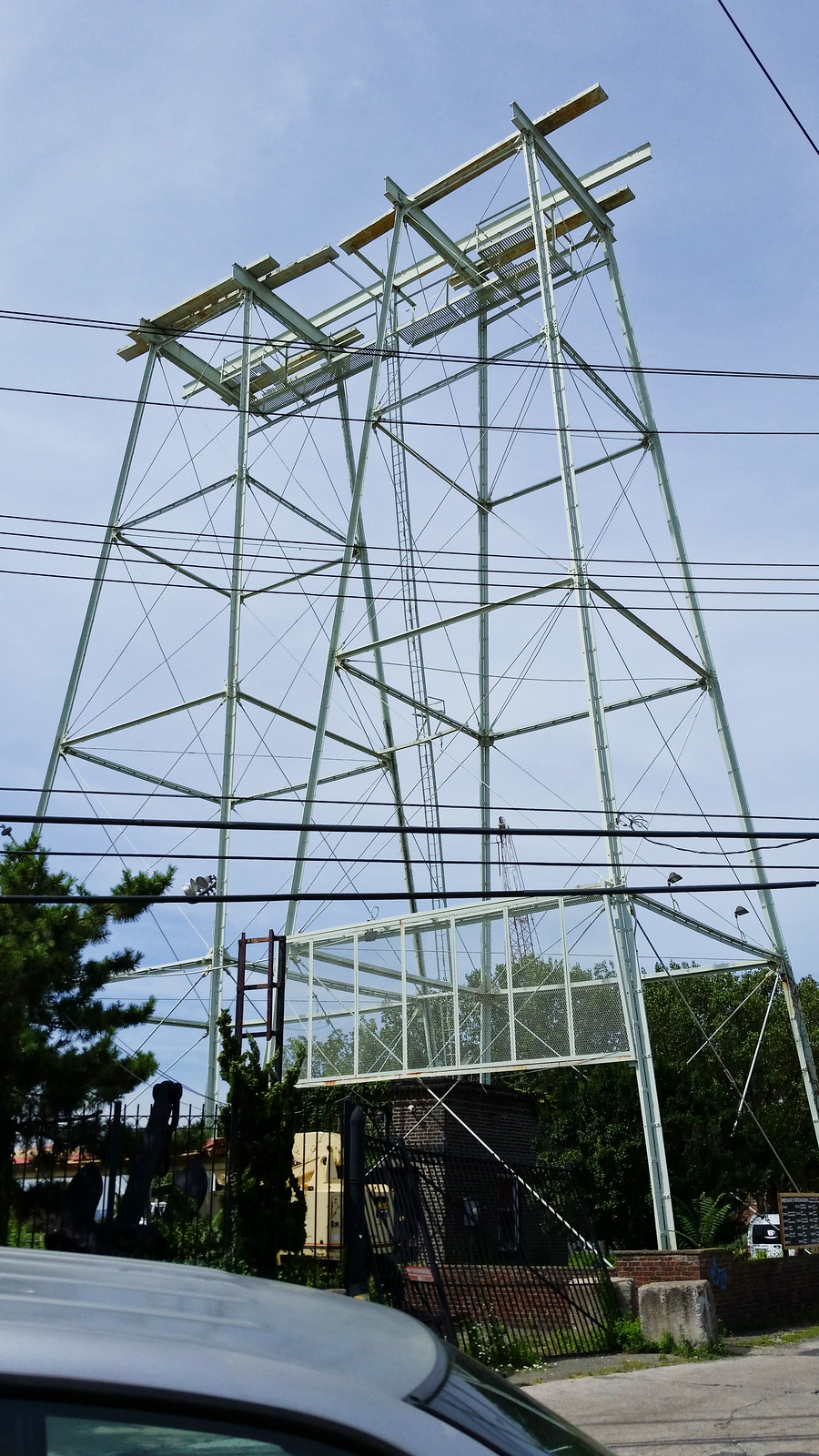
As indicated on this 1929 map, these side-by-side structures once supported water tanks. The tanks are visible in the center of this 1966 aerial image, but appear to have been removed by 1980. (I had to stare at those images for a long time before I was able to understand what I was seeing.)
Built in 1873, these two handsome brick warehouses on Pier 41 in Red Hook are known as the Merchant Stores. They once served as "a bottling plant for the Morgan Soda (later White Rock Beverage) Company", according to the AIA Guide to New York City, and are now home to such enterprises as a winery, a glass-bending shop, and a coffee-roasting collective.
Down at the far end, in what was previously used as the residence for the cast of MTV's The Real World: Brooklyn, is an event space called the Liberty Warehouse, presumably named for its proximity to, and view of, the Statue of Liberty. I took a look at the "Information" page of the venue's website and found this absurd claim: "The Liberty Warehouse is the only location in all of New York where the Statue of Liberty is face front as she looks on to France."
1) There is nothing special about the Liberty Warehouse's location in relation to the direction the statue faces. While you can certainly see her face from the warehouse, you're not particularly close to looking at her dead-on: the warehouse is angled more than 23 degrees off the centerline of her gaze. (This fact is conveniently illustrated by the big photo of the statue, presumably taken from the warehouse, that can be found alongside the text on the "Information" page.) If you want a direct look at the statue's face from the waterfront, you'll have to head over to the foot of 42nd Street in Sunset Park, about a mile and a half away as the crow flies.
2) While Lady Liberty was a gift from the French, she was not positioned to look toward France. In fact, she faces more than 90 degrees away from Paris. In search of another way to express how erroneous the website's claim is, I decided to figure out what country she actually is staring at across the ocean. Brazil? South Africa? Whatever it is, it would surely help drive home the fact that she's not looking anywhere near France. So I pulled up a map, plugged some coordinates into these handy tools, and discovered that after crossing the Atlantic, her gaze makes landfall in the nation of... France. Not the mainland in Europe, of course, but the overseas department of French Guiana in South America. So I suppose the "looks on to France" part of the website's claim is technically correct. Damn!
(The "Information" page mentioned above also claims that the warehouse was "constructed in the pre-Civil War 1850’s". I'm no expert on the subject myself, but I'd say the AIA Guide, which provided the 1873 date I gave above and specifically states that the Merchant Stores and other similar warehouses in the area were built after the Civil War, is a far more trustworthy source on the matter than the Liberty Warehouse people.)
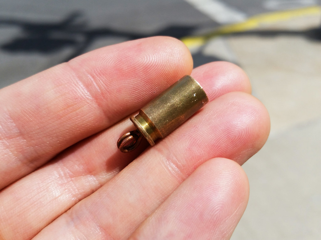
Note the loop attached to the end. Was someone trying to turn this shell casing into jewelry?
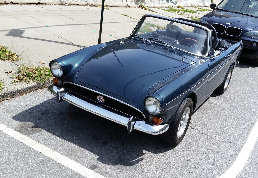
This is either a Sunbeam Alpine or a Sunbeam Tiger (the V8 version of the Alpine). I had never heard of these cars before, but they've had some impressive movie and television roles. The first James Bond car, as seen in 1962's Dr. No, was a blue early-'60s Alpine, and Maxwell Smart drove a red '65 Tiger during the first four seasons of the TV series Get Smart, including at the beginning of the opening credits for the first two seasons. An Alpine apparently had to stand in for the Tiger on Get Smart in some instances; because of its smaller engine, only the Alpine had enough room under the hood to accommodate the car's pop-up machine gun.

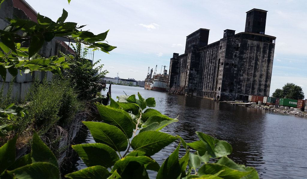
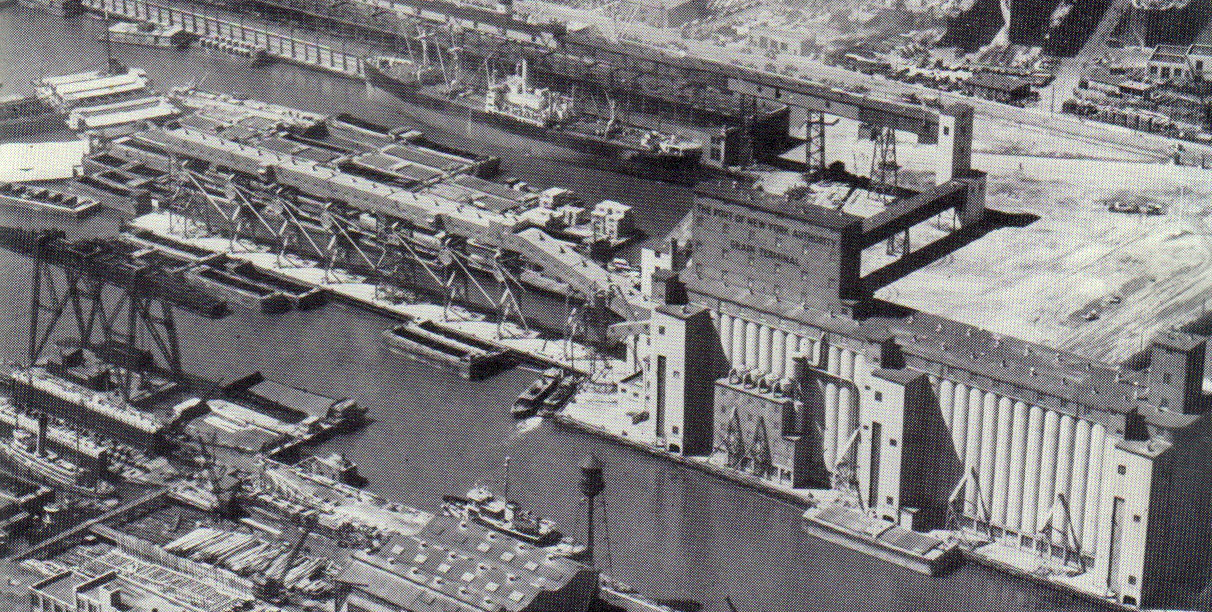
The hulking structure looming above, blackened with age, is a two-million-bushel grain elevator opened here on the Henry Street Basin in 1922 as part of the New York State Barge Canal's Gowanus Bay terminal. The elevator was built to facilitate the transfer of grain from barges (arriving via the canal system) to ocean-going steamships.
While the canal system and the elevator were "magnificent works of engineering", according to an expert quoted by the NY Times's Christopher Gray in his piece about the elevator, they were also "magnificent boondoggles" that failed in their attempt to recapture grain and other freight traffic that had been lost to railroads in the years since 1880. The elevator was deactivated in 1965 and has been vacant for half a century now.
You can see an old photo of the elevator and its since-demolished conveyor structures here, and you can check out some current-day images of the abandoned interior here.
(Visible in the background [zoom in] is the city's first large-scale wind turbine, which generates power for the Sims Municipal Recycling facility in Sunset Park.)
UPDATE (Mar. 14, 2017): R.I.P. Christopher Gray, "the David Letterman of architectural history". Your Streetscapes column has long been an invaluable source of information and inspiration. Thank you for all that you've done!
The same images are painted on the other side of the entrance as well.
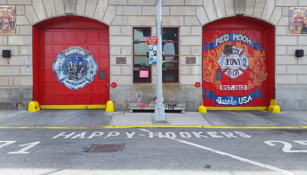
The companies stationed at this Red Hook firehouse, Engine 279 and Ladder 131, have long referred to themselves as the Happy Hookers (Red Hook, hook and ladder — get it?). But the FDNY ordered them to drop the name in 2005, part of a department-wide push to clean up company nicknames following a pair of ugly incidents — a sex scandal and a firehouse brawl — involving companies nicknamed Animal House and Southern Comfort, respectively. (Other "unbecoming" company nicknames called out by a 2005 Department of Investigation report: the Nut House, the Harlem Zoo, 90 Proof, Clown College, and First at the Bush.)
Despite the FDNY's demands, the Happy Hookers refused to remove their nickname from their firehouse door. The name remained there (photo) until 2008, when the FDNY reportedly sent someone out to paint over it. It was long gone by the time I first walked by in 2012; not knowing the companies' nickname, I was puzzled by the accompanying image of two suggestively posed firefighters that remained (and still remains) on the door.
I don't know if the FDNY has loosened up in recent years or if the firehouse just decided to defy the higher-ups once again, but, as you can see, the Happy Hookers name is now prominently painted on the street in front of the firehouse, and it also appears on a pair of plaques honoring the 2013 centennials of Engine 279 and Ladder 131.
(Also visible above, near the middle of the photo, is 9/11 memorial #73.)
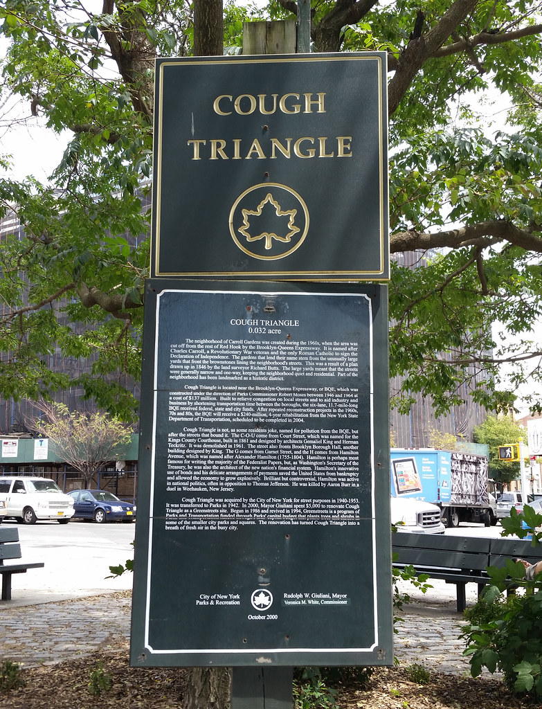
According to the Parks Department:
Cough Triangle is not, as some residents joke, named for pollution from the BQE, but after the streets that surround it. The C-O-U come from Court Street, which was named for the Kings County Courthouse, built in 1861 and designed by architects Gemaliel King and Herman Teckritz. The building was demolished in 1961. The G comes from Garnet Street, and the H comes from Hamilton Avenue, which was named after Alexander Hamilton (1755-1804).Only former Parks Commissioner Henry Stern could have come up with such a weird name in such a weird way. (And, indeed, the Parks webpage quoted above confirms that this tiny triangle was turned into a green space in 2000, during Mr. Stern's second stint as commissioner.)
Having a good feel for his wacky and mordant sense of humor at this point, I feel comfortable saying, despite the Parks Department's claim to the contrary, that Mr. Stern was almost certainly thinking about the air pollution from the adjacent, traffic-clogged Brooklyn-Queens Expressway (BQE) when he named Cough Triangle.
I can picture it now: He's looking at the triangle on a map, trying to come up with an interesting name. (He's never been one to settle for a run-of-the-mill appellation, not even for a minuscule piece of parkland like this.) After noting the site's proximity to the exhaust-spewing BQE and the "miasmic, fetid" Gowanus Canal, he turns his focus to the names of the surrounding streets, a common source of inspiration for him. Court, Garnet, Hamilton. Court, Garnet, Hamilton. And then, to his great delight, it hits him. Five simple letters that are not only an authentic product of the local street nomenclature, but also an oblique jab at the area's questionable air quality. COUGH! Chalk another one up for the maestro.
At 87.5 feet above street level, the Smith-9th Streets station, served by the F and G trains, is the highest subway station in the world, according to the MTA. (191st Street in Upper Manhattan, on the 1 line, is the city's deepest station, 180 feet below ground.)
From June 2011 until April 2013, Smith-9th was closed while it was being renovated (by a team of space aliens, it would appear). The station is open and functional now, but work on the exterior continues, as you can see.
UPDATE: The renovations are complete! Here's a look at the finished station.
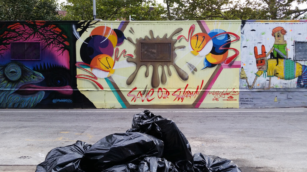
I find the Royal Kingbee making an appearance on the Centre-fuge art trailer.
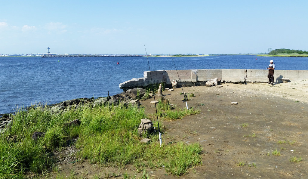
This is Motts Point in Bayswater Point State Park. You can see JFK Airport across the water (zoom in).
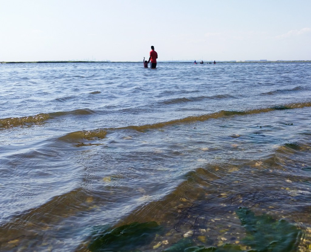
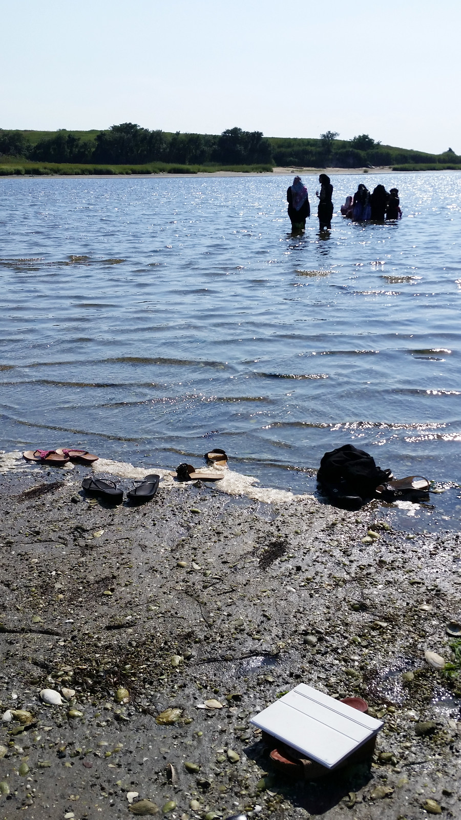
Jamaica Bay is much more popular with boaters than bathers — in fact, I don't think I had ever seen a single person taking a dip in the bay before — but there were almost twenty people hanging out in the water today at Bayswater Point State Park.
If you zoom in, you can just make out the faint skylines of Lower Manhattan and Midtown in the distance.
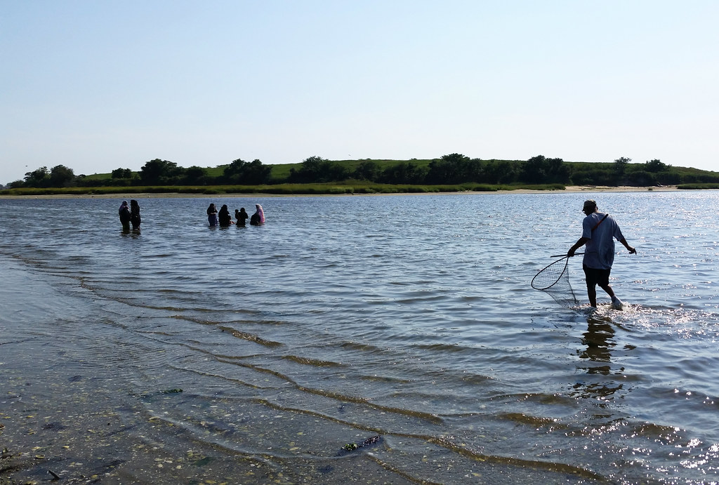
Everyone I saw in the water at the park today was fully clothed; the women at left are wearing hijabs.
The hill in the background is the old Edgemere Landfill.

Bayswater Point State Park is the former site of "what may have been the biggest mansion to go up in Far Rockaway", a 175-foot-long "mix of Tudor and other English styles" (old pictures here and here) built around 1907-08 by the banker Louis A. Heinsheimer. Mr. Heinsheimer wasn't given much time to enjoy his luxurious new palace, however: he died in early 1909 following an operation for appendicitis.
In 1925, with "Far Rockaway [having] lost most of its pretensions of grandeur", Mr. Heinsheimer's brother donated the mansion to a hospital to be used as a "convalescent home for crippled children". According to a 1987 Time magazine article, the house subsequently served as
a private school for retarded children and later a rabbinical school. Now it is a bag lady of a building. A fire has destroyed much of the roof; plants grow in piles of rubble; the bones of rodents lie in corners. Vandals have smashed windows and sprayed the walls with graffiti.The article goes on to describe how a salvage company was at that time removing "window frames, carved moldings, gargoyles and anything else of architectural interest that can be pried loose and sold" prior to the house being demolished and the property turned into parkland.
The only part of the structure left standing in the park was the conservatory, seen in this 1996 aerial image, although that too has come down in the years since. The mansion hasn't quite been wiped off the face of the earth, however. As pictured above, its foundation can still be seen poking up through the grass in the middle of the park (aerial view).
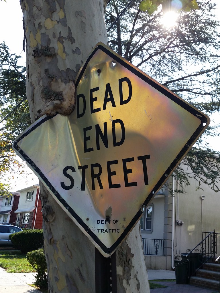
The Department of Traffic hasn't existed since the late 1970s or '80s.
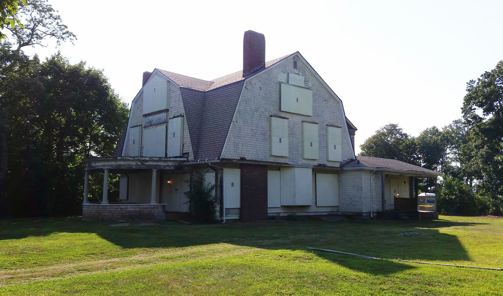
Now part of Bayswater Point State Park, this "circa 1900 shingle-style house" was reportedly once an inn; the name "Sunset Lodge" can still be found on its gateposts.
The last person to own the property was Victoria Greenidge, a wealthy recluse who bought the place with her husband Joseph in the 1940s. The couple outfitted the house with "fine furnishings and antiques" but never actually moved in, residing instead in a guest cottage around back. They began hoarding newspapers and filled the cottage with so many towering piles that there were only narrow "channels" of open space remaining for getting around from room to room.
In the years after Joseph died in 1972, Victoria began slipping into senility. In her vulnerable state, she fell victim to an "allegedly criminal pattern of undue influence by a succession of lawyers, workmen, housekeepers, advisers and helpers" looking to get their hands on her money. Despite her considerable financial resources, a 1980 NY Times article found her living a "pauperlike existence" in a nursing home at the age of 78 or 79.
Following her death in 1985, Sunset Lodge and the surrounding land were handed over, in accordance with her wishes, to the Audubon Society, which later sold the property to the state parks agency. The house, thoroughly looted and vandalized by the time Victoria passed away, has stood vacant ever since.
There is a glimmer of hope for the place, however, as the state recently dedicated $80,000 to stabilizing the structure. Thinking optimistically, the local city councilman in 2010 proposed turning the house into a bed-and-breakfast, but I imagine it will be quite difficult to come up with the money for a full renovation.
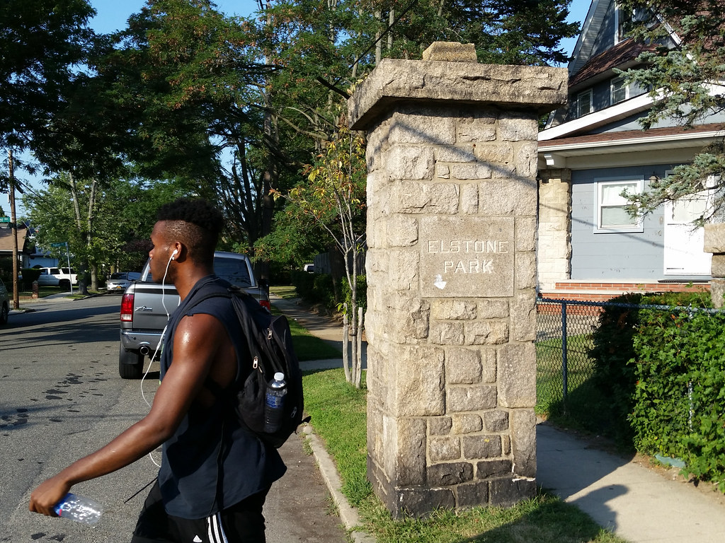
Elstone Park was an early-20th-century residential development here in Bayswater. As far as I can tell, its first houses were summer cottages that were rented out starting in 1906. Sales began in 1908, when the "substantially and artistically constructed" furnished cottages were put up for auction, along with "large villa plots" for buyers who wanted to build their own homes.
The Elstone Park Realty Company also thoroughly remodeled the nearby Bayswater Hotel, which had been closed for some time, and reopened it as the Elstone Park Hotel in 1908. According to some newspaper ads from 1912, the new and improved hotel had much to offer its guests, including unsurpassed cuisine, high-class cabaret, bridge whist, and Japanese servants.
The hotel seems to have been a social hub for the community as well, hosting such events as an "old-fashioned country dance", a "fancy dress dance" at which prizes were awarded for "the prettiest, most original and most grotesque costumes", and weekly Friday-evening "amateur nights" that "opened a new field for the young genius[es] who desire to acquire fame in the footlight world".
One unusual remnant of Elstone Park exists in the form of an odd midblock traffic circle on Granada Place, just down the street from where I took this photo. Today the circle is home to a modest assortment of grasses, trees, and shrubs, but it was once the site of an elaborate fountain, reportedly lit up in the evening by colored electric lights, that was built as a centerpiece of the development. You can see an old postcard image of the fountain here. And this postcard features a view down Granada Place (then known as Summit Drive) from around the same location as my photo above. You can see the fountain in the background, and you can also see the stone pillars that are still standing today, the taller of which were apparently once topped by ornate lamps.
In 1912, William S. "Big Bill" Devery, a former NYC chief of police (from 1898 to 1901) and an owner of several Elstone Park houses, took the head of the Elstone Park Realty Company to court for removing four statues of goddesses from the fountain. I was surprised to find such a seemingly mundane dispute covered in a number of different newspapers, and, in a couple of cases, in such an enthusiastic and over-the-top fashion that I couldn't even tell for sure which parts were meant literally and which were jokes.
It turns out that Big Bill had long been a favorite subject of the press. He was a juicy target during his days with the police department, a brazenly corrupt chief growing wealthy off of graft money. At the same time, his colorful, quotable, "picturesque" personality endeared him to the very reporters trying to take him down. As the crusading journalist Lincoln Steffens once put it: Devery was "no more fit to be a chief of police than the fish man was to be director of the Aquarium, but as a character, as a work of art, he was a masterpiece."
Devery was also an original co-owner of the New York Highlanders, the baseball team now known as the Yankees. He and his partner owned the franchise from 1903 to 1915, and legend, if not established fact, has it that he gave the team its famous N-superimposed-on-a-Y insignia, borrowing the design from an old police medal of honor (photo) created by Tiffany & Company.
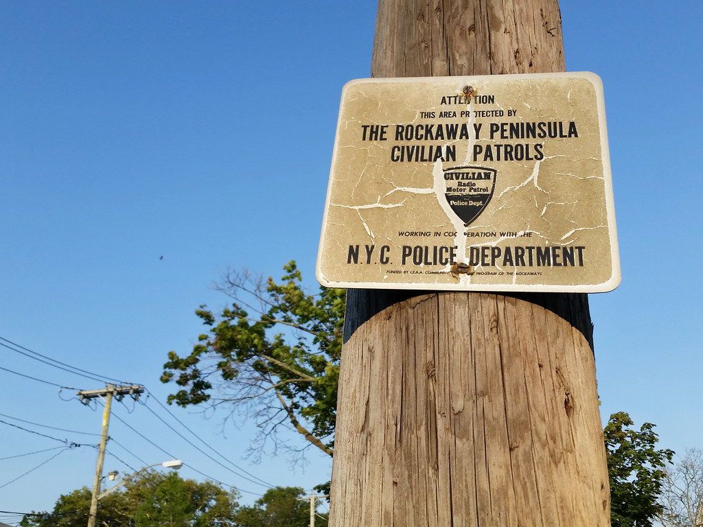
THIS AREA [apparently used to be] PROTECTED BY
THE ROCKAWAY PENINSULA CIVILIAN PATROLS
Civilian Radio Motor Patrol
Direct Contact With Your Police Dept.

"WELCOME" is carved into the bottom step of the row house that faces this bench.

