I'm walking across America.
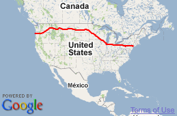
That's the idea, at least. I'm walking westward from New York City for nine months or so. If everything goes according to plan, I'll be in Oregon when the clock runs out. If nothing goes according to plan, maybe I'll end up in Peru or Mongolia or Pennsylvania. You can read all about the details of my trip if you're so inclined.
Email me at matt@imjustwalkin.com
Subscribe to my email list
Here's my progress so far:


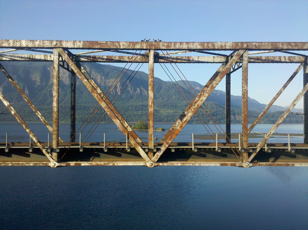
A rusty old tin can…but it does have a beauty all it’s own…am I first…well, well…
Agreed, Jim in AR. I see the beauty in the bridge, too, as well as the spectacular view.
http://www.google.com/images?hl=en&client=safari&rls=en&q=PIctures+of+Wind+RIver,+WA&um=1&ie=UTF-8&source=univ&ei=BmFtTM6-NIL58AaRqInWDQ&sa=X&oi=image_result_group&ct=title&resnum=1&ved=0CB8QsAQwAA&biw=916&bih=614
I hope the road you’re walking on is safer than that bridge looks!
How in the heck did you take that picture? It seems like you had to be floating in air :-) Too cool.
and you realy thought he was walking this fast……dam secret is out. Put the rocket boots back matt.
A question for someone who knows the area…if Matt is going to finish at Rockaway Beach…I didn’t look at the route he is taking for a while…but he will have to take a jog to the South and therefore away from the Columbia, right???…So we will miss some of that beauty and maybe windsurfers???…
The Columbia turns north a bit at about Portland. He’ll probably leave it around there and head straight towards the coast and his final destination. :)
His course has him crossing the Columbia in Stevenson to Cascade Locks. Then he will travel along the historic highway. When he drops down in to Troutdale/Gresham he will leave the Columbia River behind and head to the coast.
Um…maybe, but the Bonneville crossing is much more dramatic from a photographic point of view!
I see a small island! Must be an awesome place to have a picnic.
That would be so cool to hang out on that island for awhile (assuming everyone else doesn’t have the same idea at the same time!)
If you can get to it. :)
Awesome bridge… looks like it’s been around awhile!
Only around 130ish miles left to go!
Ok, after looking closer, it’s probably closer to 150ish. :)
At the pace he’s going he could be in Rockaway by Monday, the 23rd. Whoo-hoo! The end is near, Matt. We’ll miss following you, but I’ll be celebrating with you on your mission accomplished.
This picture is amazing! I love the mountains in the background and I love the island! This would be a great place to visit. Great picture Matt!
Matt, did you see the bird’s nest?
The design looks a little like a square and compass,a sign of masons and builders,not so popular now a days…..or it could just be intersecting structural rods.
Hard to imagine it supports the weight of itself, let alone a train…
These Bridges of this design will carry loads well over what they were designed for. These type Bridges transfer the load Forces from one end of bridge to other thru top and add in track spans all the weight is low when broke down to square feet area it has to carry. Thanks Trusman
Rusty steel truss bridges are frightening and reminiscent of the I-35W Mn incidence. Wonder how often WaDOT inspect this thing?
If it’s a train bridge they don’t. All train tracks are the property of the train company that owns them.
I love the composition of this photo.
Me too CP! The structure is completely suspended in mid-air and perfectly encapsulates the mountains in the frame of the bridge. Such a sense of space.
I love this photo. Beautiful!
Beautiful river. Beautiful weather you’ve been having too. Makes for a much more enjoyable walk I would think.
As far as the bridge goes it’s nice, a little rusty looking but doesn’t look like it’s falling apart.
awesome picture – saw the title and had to look as the only Windriver I know of is in Wyoming