
After several forays through swamps and fields, and a climb onto a railroad embankment, I finally made it out to a more walkable road.
Day 84
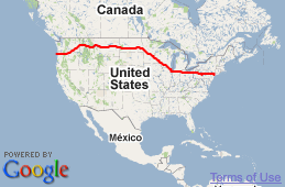
Google and I apparently have different opinions on what qualifies as a “street”
June 18th, 2010
After several forays through swamps and fields, and a climb onto a railroad embankment, I finally made it out to a more walkable road.
Google used to tell you to swim from New York to Europe…so this is just a minor mistake! Good luck…at least you don’t have alligators and rattlesnakes to contend with.
Matt: Beware you are approaching Jamestown. DO NOT DRINK THE KOOLAID
This is a perfect example of why you can’t trust a GPS or Google maps. There are mistakes that lead you into dead ends. Why, I have no idea but they do. Hope you aren’t trespassing onto someone’s property. :0) Be safe and finds some better roads. Or better yet, hop that rail road train! Whoo! Whoo! Chugga chugga chugga!
hay thats my line……he won’t listen to me….Maybe a woman..!
Or does he……The evil Toy Slayer weeves his evil plan…!!!!!
Hay Matt….cant see a thing from here…(picutures blocked) but I imagine alot of water and a WTF.
Peace, Keep pushing, Don’t Let your job stress you out…the weekend is upon us. Stay safe my friend. Safety first. And I remeber the swim from new york directions….
Looks like a regular freeway there!
Can’t go over it…can’t go under it…guess you’re going to have to walk it. I remember this from some silly story from my great-grandmother many years ago. There were other parts too about climbing a tree, swimming a lake to hunt for something or other.
Goin’ on a lion hunt, gonna catch a big one, I ‘m not afraid, are you…….then on to the tree, lake, briar patch etc. Good analogy! That was a chant from camp days gone by!
Going on a bear hunt….
I’ve been trying to pinpoint your location … my google definitely shows almost no road, at least on the satellite and a lot of it is just barely visible. Very confusing landscape on satellite.
How frustrating. Should have stayed on 33 I guess … keep heading west, my friend, you should be out of it soon.
Gotta love modern technology at its finest. I did a gps trip in a car 7-8 years ago going into New Brunswick Canada, 4 lanes into 2, blacktop to gravel, to the top of a hill that that became a drop off with no sign, thankfully I was creeping along and had a small car. Wishing you drier miles to come.
Hahah that sucks! Hopefully, it gets even better.
You should see this road at rush hour.
Hahaha! That might be “mush hour.” ;-)
I believe this is RUSH HOUR!
That’s what you get when you get to ND! Sorry, Had to throw in a jab at ND. :)
At least you’re not using map quest. I trust Google Maps way more than that!
Keeps the rif-raf out…..and in MN ~ sorry, I had to jab you back. I actually teach there and it isn’t too bad, most days….
This photo reminds me of Remember The Night, a great Christmas movie where Fred MacMurray and Barbara Stanwyck get detoured and spend the night in their car in a pasture before getting arrested as trespassers. Just don’t milk any cows Matt, that’s what got them into trouble.
A favorite movei of mine! :)
Hope you got your skeeter spray!!!!!!
Keep west….hug the narrow path….and beware of the drivers from england.
dude….so smoth so far…..just a hic cup. Maybe a beer waits at the end of the path.
I see a house or building on the far upper right and is that a blacktop on the far right or is it train tracks? Hope your day gets better Matt. Well, it’s 5:22pm CDT here in San Antonio and quitting time for me. I will meet up with you again on Monday. Have a safe weekend. Oh, are you going into Montana right where ND, SD, & Montana meet? If so the ranch right there is owned by the Logar’s. It’s sheep and cattle and they are great people. I was in the Army with their daughter Theresa and went for a visit a couple times. The will definitely give you a place to rest and a great safe raised steak to fill your stomach. Have a great weekend.
Suzanne
Knowing by your caption that you finally made it out to a more walkable road, I can see the hilarity in all of this, but what a pain in the butt.
I love a good adventure, too, but this sounds more like work than fun. Hope the rest of the trip today was far less eventful, and that you are by now hunkered down somewhere warm and dry, and being well fed.
“Make your own road”
the road is where ever you put your feet on… i envy you matt. keep it up.
It occurs to me that what you are encountering is why so many good people are FROM North Dakota.
Witty.
At first I thought you were joking….
..but whoa “batman”!
Hope you brought your “high waters”?!
Use Bing Maps. They have good Satellite images so that maybe you can avoid stuff like this in the future. Stay safe!
Well it looks like you’re along 34-1/2 St now. Maybe the 1/2 on the street name indicates a half-finished street ;-)
What an adventure- glad you made it out! It really is amusing from this end… not so much if I had to push the cart through it all. Hope you kept your humor through it all…
When we drove cross country (no reservations just driving -the goal was to see my family in Mass from AZ) Was a good thing for Rand McNally, we would have ended up on roads like this if not for the map!!!! YES the one with paper pages and not satellite…LOL Oh and since we had just bought a new GMC (came equipped with onstar) The best of both worlds!!!….such a great experience!!! Walk on Matt!!!!
hey the best roads are the ones less traveled so thats prob the best rioad youll see the whole trip matt keep on truckin dude
Yes Matt, the road less traveled……..enjoy it!!!
Many maps, including Google, are drafted from aerial or satellite photos. A trail that appears clearly in a fall/winter photo could show up as a road on the map, even if it isn’t passable most of the year. Even USGS maps sometimes include “roads” like this. Even more common is to see rail lines that have been gone for half a century or more.
Despite the occasional errors, it’s pretty amazing that you can see Matt’s location on your computer and maybe even see a street-level view. Almost as good as being there – well, not really, but probably as close as I’ll get.
Judging from the google satellite view it looks to me like at one point it may have been a graded road but was washed out. The map that was associated with the flickr archive showed a really curvy cross-road and that was pretty obviously a creek on the satellite … very close to where you got off the “road” … just one of those things I guess. Just keep heading toward the setting sun, you’ll hit Montana.
Isn’t this just one more wonderful thing about the Great Plains States? I truly love North Dakota and its people: it is wild and untamed still (in parts) and even the “tamed” areas are beatiful and cause one to feel connected to the earth in a way one can never feel in a city. Didn’t it feel FANTASTIC to make your way through and know you were up to the challenge? !! :-)
Next time use MAPQUEST instead.
When I moved to my new house on the plains above Great Falls google said that there were 3 ways to get here…This winter we had a snowstorm that buried the roads so thick even the tow trucks were getting stuck, so we thought oh theres that 3rd way we haven’t taken yet! Yeah right it was a dirt path behind barbed wire fence that said NO TRESPASSING in giant letters…