I'm walking across America.
That's the idea, at least. I'm walking westward from New York City for nine months or so. If everything goes according to plan, I'll be in Oregon when the clock runs out. If nothing goes according to plan, maybe I'll end up in Peru or Mongolia or Pennsylvania. You can read all about the details of my trip if you're so inclined.
Email me at matt@imjustwalkin.com
Subscribe to my email list
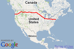
Here's my progress so far:


Congratulations on crossing over into Oregon Matt. Enjoy the rest of your walk…
Sorry he is still Washington, just across the river from Oregon.
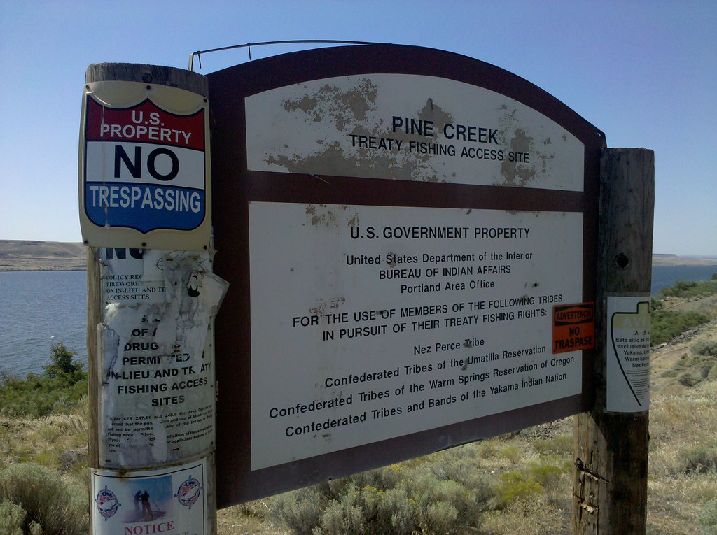
whoa. wait a minute. this photo was taken in Oregon….that can only mean one thing……he’s in the home stretch!
hey, did anyone happen to notice that on the map, the Boardman OR bombing range, is just shy south of the Boardman airport? now tell me, what’s wrong with that setup, eh?
how coincidental is this? you never hear of this place, and within days of each other, Matt passes thru on his walk, and this article shows up in the press: http://news.yahoo.com/s/ap/20100814/ap_on_re_us/us_refugee_dairy_workers;_ylt=AooyIIQnOKCHEAp_hV3qjcas0NUE;_ylu=X3oDMTFlcmU4ZHZxBHBvcwM2NQRzZWMDYWNjb3JkaW9uX3Vfc19uZXdzBHNsawNmb3JpZGFob3JlZnU-
Oregon !!! Can you believe it??? Yeah Matt… Congrats…. here comes the beach!
So when I got the map to work < I see that Matt's still on the WA side of the Columbia…. close but not in Oregon yet… just a tease away…
They made a big thing when a person half black/half white became the president of the united states. What a complete and ultimate event it will be…when a Native American becomes President of the land that was slowly removed from their possesion. And they were given small chunks to call their own when they were the origional keepers of this treasured land.
Jeff hope I’m alive to see that. We really did the Native Americans a huge injustice.
Agreed….what Barb said….
Agreed. And what a weird thing it would have been for their ancestors to see these signs stating “U.S. GOVERNMENT PROPERTY”. I understand that the purpose is to preserve the land for their use, but it probably wouldn’t have been any government’s property if they’d had it their way.
Flickr says the pic was taken in Willows, Oregon. Congratulations Matt! After 140 days of walking you’re on the homestretch of your journey. You must be both relieved and excited at the same time. For us in the Hobo Nation it’s a bittersweet feeling, we are as excited as you are but a little sad that the trip has to end. I’m still rooting for that book though. Enjoy the rest of the journey!
yeah jeff i guess we were the original illigal immigrants!!!!
it is truly remarkable to have traversed the usa in such a short time.
I think Willows might be a triangulation marker for his GPS system..His tracking said at this time he was definitely on the North side of the river, which is Washington…the two states are separated only by the river (which is essentially cut in half by the state line) Willows (willow creek) is located South of 84 in Oregon in the middle of nowhere. At least from what google says. I followed this road last year to Nehalem (a little north of Rockaway beach) our main highway 84 took us right next to the Columbia on the south side it’s a 4 lane, while a two lane highway stretched the north side on the banks of the Columbia, in Washington. One of the pics in this set faces the sunset with the river on the left….which says he is probably still in Wshington here.
See the little bit of land beyond the water on both the left & right sides of the sign…? THAT’s Oregon ;-) Trust me, I’ve driven the Columbia Gorge so many times I could (almost) drive it with my eyes closed.
Wow, I can’t believe life got away from me and I missed you while you were actually in WA.
CPinMI – I was worried for a moment you were my boss, following me following Matt. But your comment makes it sound like you’re actually from WA, or maybe recently visited, and I know my boss hasn’t been there recently…. whew! That or you’re really him pretending not to be… Thought I was busted creatively using my lunch hour at different times of the day. :)