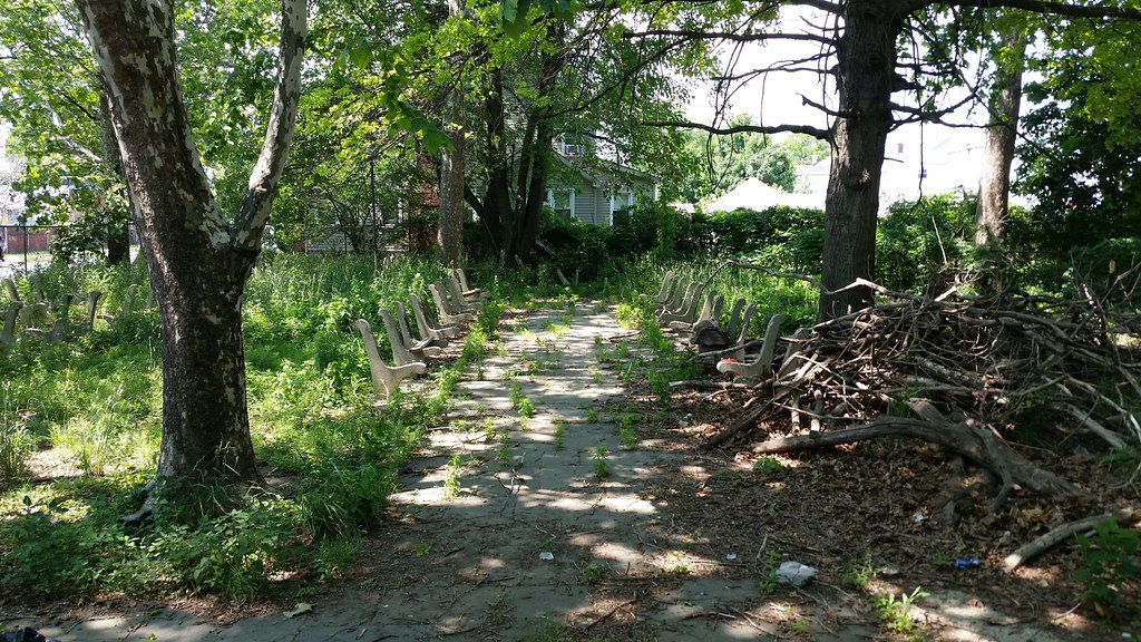
Studded with the bones of old benches, this vacant parcel of land was once a private park for an apartment complex across the street. The unusual shapes of this lot and its two neighbors to the east — the northern boundary line of the three properties runs diagonally across the street grid — can be traced back to the swath of farmland that once existed here and the dirt road that ran along its northern edge, as seen below.
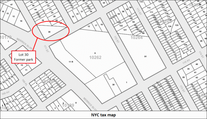
Links for further inspection: tax map, 2012 aerial, 1951 aerial, 1924 aerial.
Day 1262
A park no more
June 14th, 2015

