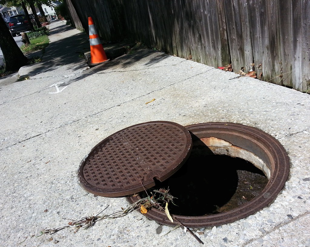
If you look closely, you can see "B of R" inscribed on the manhole cover; this means it predates 1975, when the Borough of Richmond changed its name to the Borough of Staten Island. (Each of NYC's five boroughs is coterminous with a county; Staten Island is still Richmond County.)

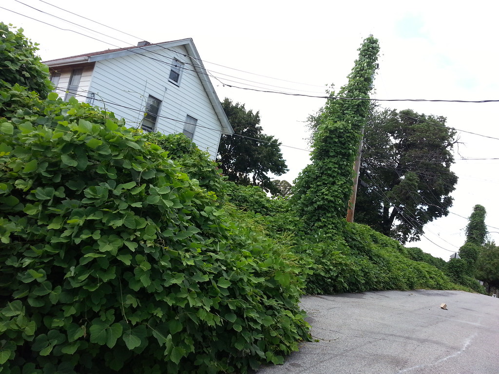
The ravenous Beast of the Southeast is expanding its domain northward.
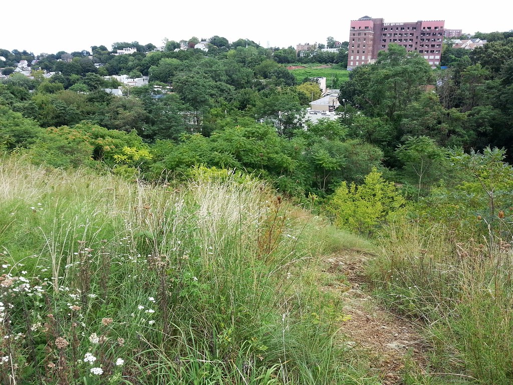
The large brick building off in the distance was part of the old Staten Island Hospital until 1979, when the medical center relocated to a larger campus. Just to its left stood a "spectacular Neo-medieval style brick structure" known as the Castle, which was was also part of the hospital complex and which was demolished just six months ago after being deemed an "accident waiting to happen" by the city.
(Just above the treeline in the center of the photo, you can faintly make out the top of one tower of the Verrazano Bridge, the longest suspension bridge in the Americas.)

From the NYC Landmarks Preservation Commission's 1969 landmark designation report: "One would sooner expect to read a description of such a house in an historical novel, rather than come upon such an actual structure still standing within the confines of New York City."


Taking advantage of locally produced greenhouse gases?

Until the 1930s, this pond was part of the water supply for the nearby Sailors' Snug Harbor.

Known as Monkey Hill (you'll see the hill in two upcoming photos), this is the final resting place of more than 9,000 "aged, decrepit and worn-out" seaman who once called Snug Harbor home.
But where are all the graves? The guy cutting the grass told me the brass nameplates that once served as grave markers were removed after people starting stealing them to sell as scrap metal.


That's what Mr. Lawnmower told me, anyway; this is just inside the woods at the edge of the cemetery.


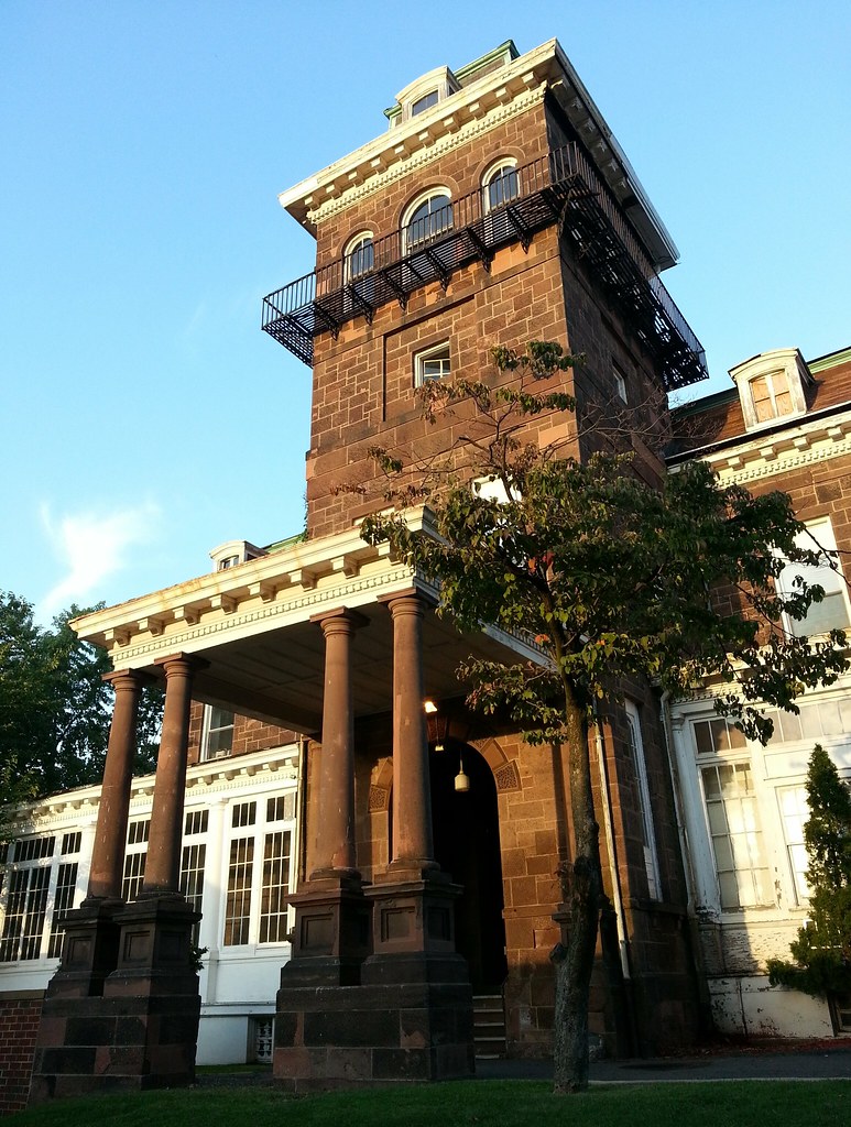
It's said that Ulysses S. Grant was once interested in making this estate his post-presidency retirement home, but his wife vetoed the move after being attacked by a swarm of mosquitoes during a visit. Years later, in 1903, it became the new Staten Island branch of St. Vincent's Hospital; it's now part of Richmond University Medical Center.
Perhaps Jesus and Mary were forced out here when St. Vincent's Hospital became the non-religiously affiliated Richmond University Medical Center (although there are still a fair number of crosses hanging around).
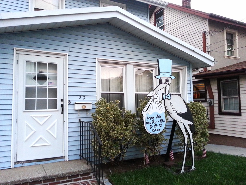
The mother's face is visible in this image; you'll have to zoom in to see the baby's butt.


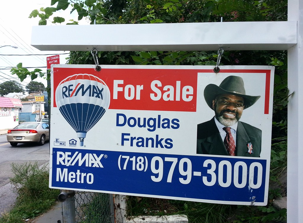
Douglas Franks seems to be selling about every fourth house in Staten Island.

Founded in 1907, it's not to be confused with the massive synagogue of the same name in Manhattan.
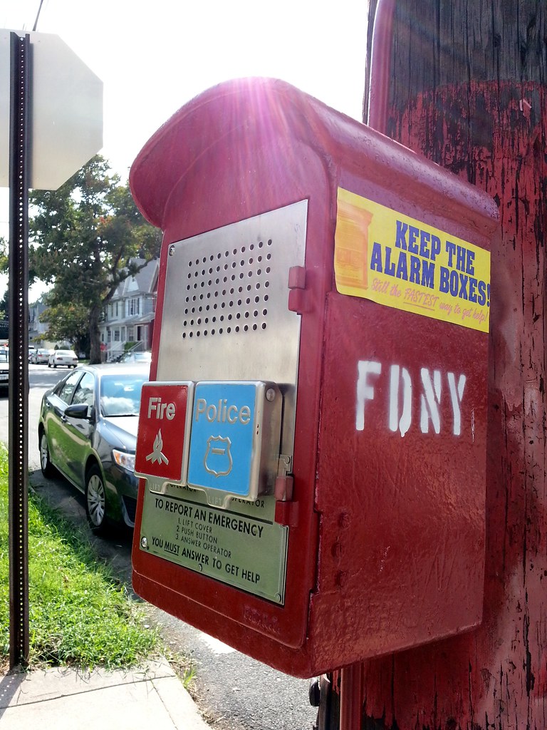
The city's been trying to get rid of these often overlooked alarm boxes for years, but the courts have yet to cooperate. (Although, as we've seen, plenty of boxes have in fact been abandoned.)


That's a '38 Plymouth in the driveway and a '53 Mercury on the street.

The stone here is actually diabase, not granite, but I guess the two are easy to confuse. Either that, or none of the 19th-century residents of the area wanted to live in a place called Diabaseville. The quarry is now officially a park, and is on its way to looking like one.

Staten Island is generally considered the least pedestrian-friendly borough, but those traveling by foot do enjoy at least one advantage over larger vehicles here: we are regularly provided with cute little crossings to carry us over the streams that remain unbridged for automotive traffic.


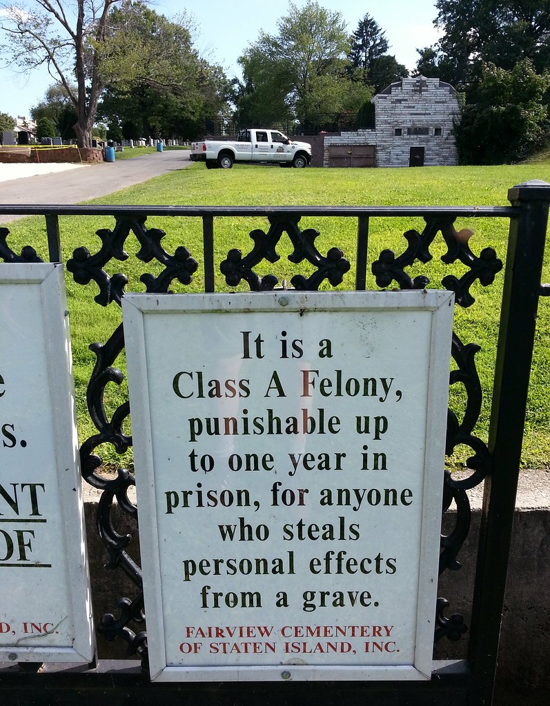
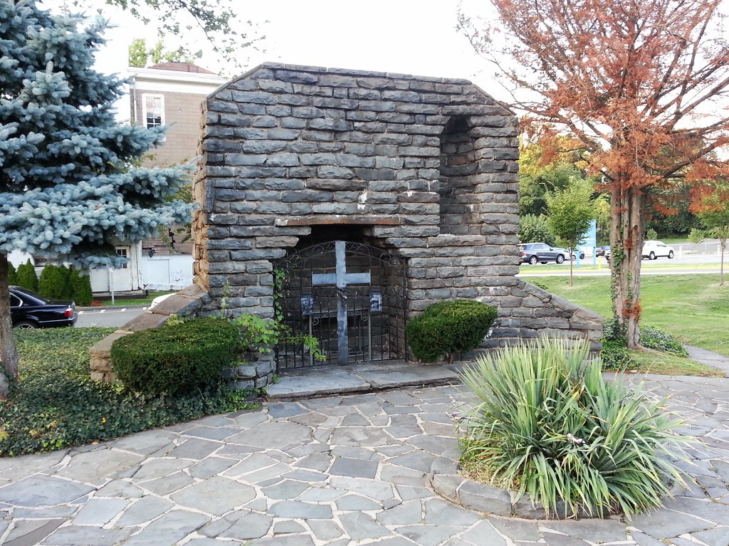
The structure to the right of the truck is the "Perpetual Tomb" — built to keep the zombies from ever escaping?
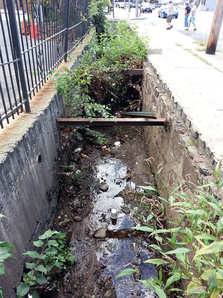
This mostly subterranean tributary of Palmer's Run catches some daylight for about 60 feet as it runs alongside the aptly named Water Falls Italian restaurant.


As recently as 2005, however, there were active tanks stationed here at the Manor Road Armory.

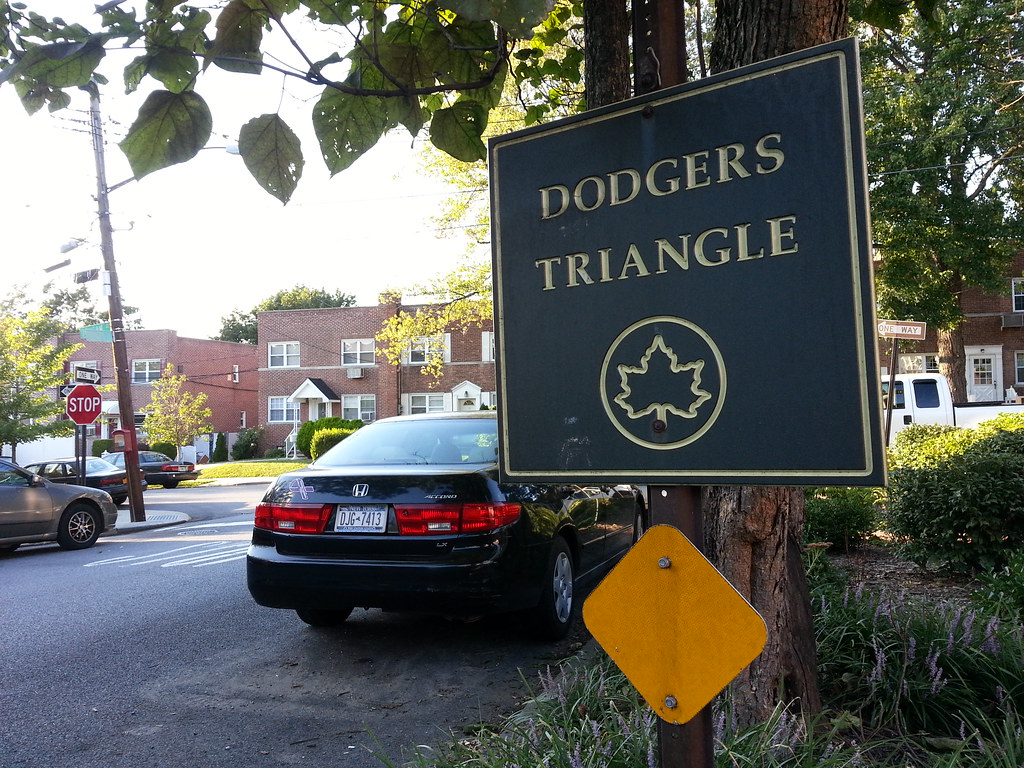
This little parklet is so named because it is bounded on one side by Hodges Avenue, which calls to mind — but otherwise bears no relation to — Dodgers legend Gil Hodges (whose grave we visited back in January). This sounds like a classic Henry Stern move; he similarly gave the name "Old Hickory" to a Long Island City park on Jackson Avenue, which is named for John C. — not Andrew — Jackson.