
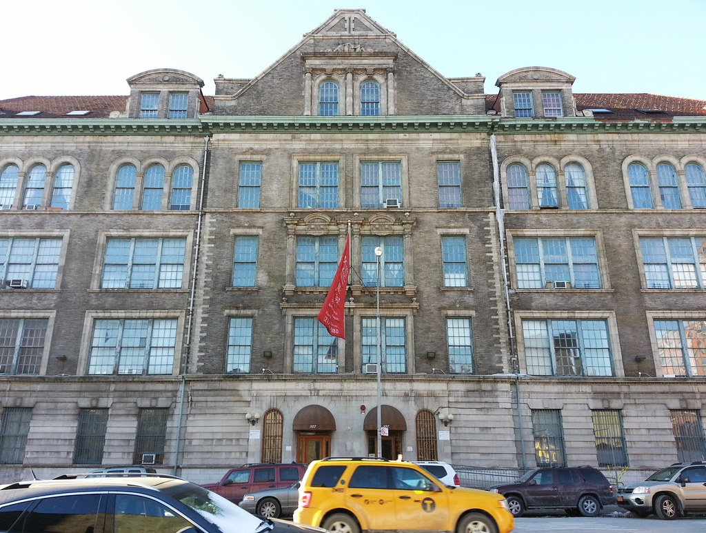
This Charles B.J. Snyder-designed former elementary school has been converted into a 73-unit apartment building "with soaring arched windows and ceiling heights of 15 feet".
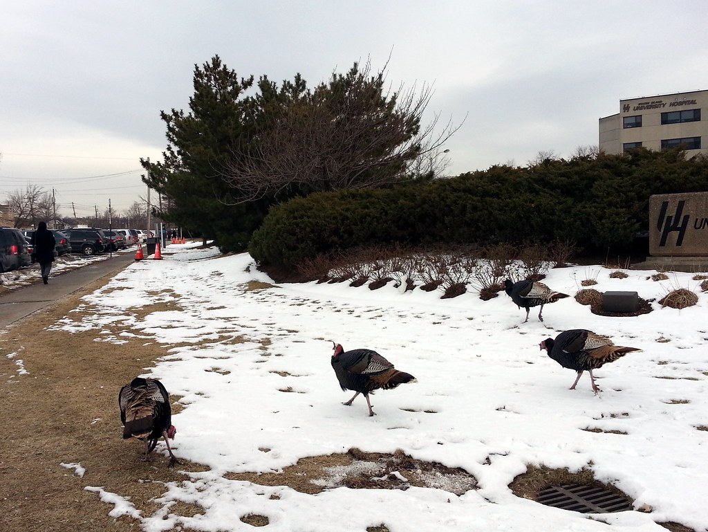
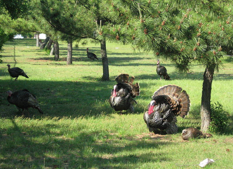
State officials say it all began when someone released nine turkeys on the grounds of the South Beach Psychiatric Center in 2000. Now there are dozens of the birds living at the psychiatric center and in nearby areas. While some locals love them, others think they're nothing but a bunch of pooping, garden-eating traffic hazards. Last year, the USDA began removing turkeys from the psychiatric center's property, sending a number of them off to slaughter and relocating 28 others upstate, but there are still plenty left wandering around.
I first learned about these turkeys when I encountered some a few years ago in late spring. I got a good shot of two males strutting their stuff for the ladies.
(We also ran into a couple of turkeys last year at Woodlawn Cemetery in the Bronx.)
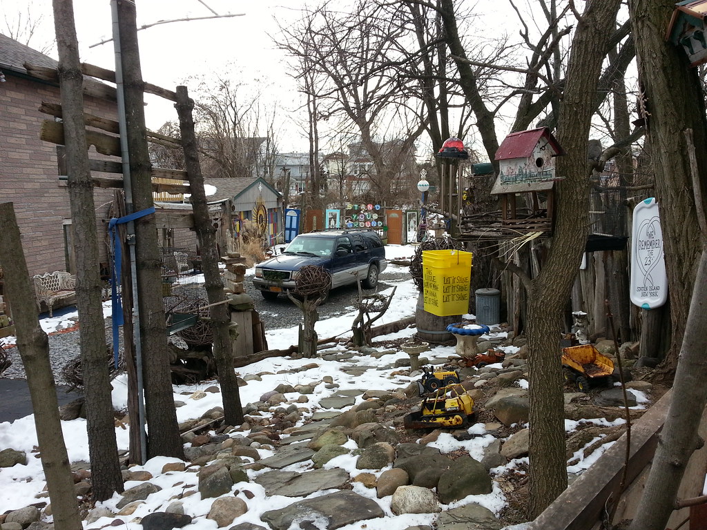
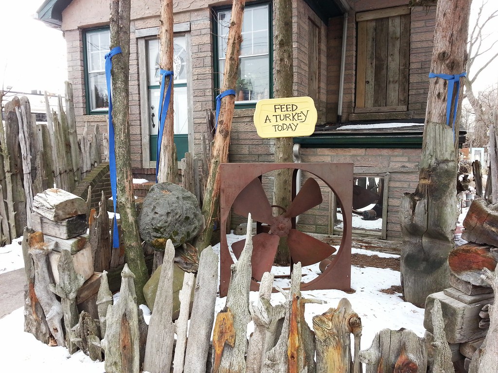
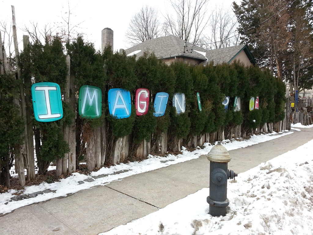
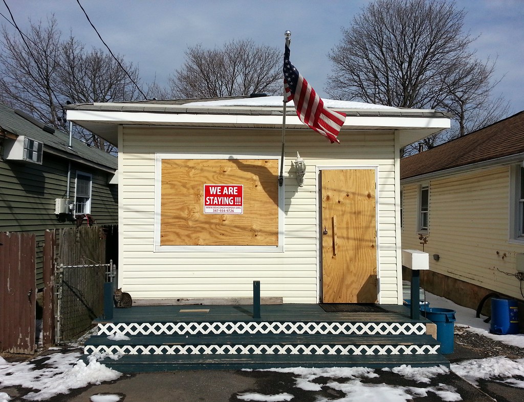
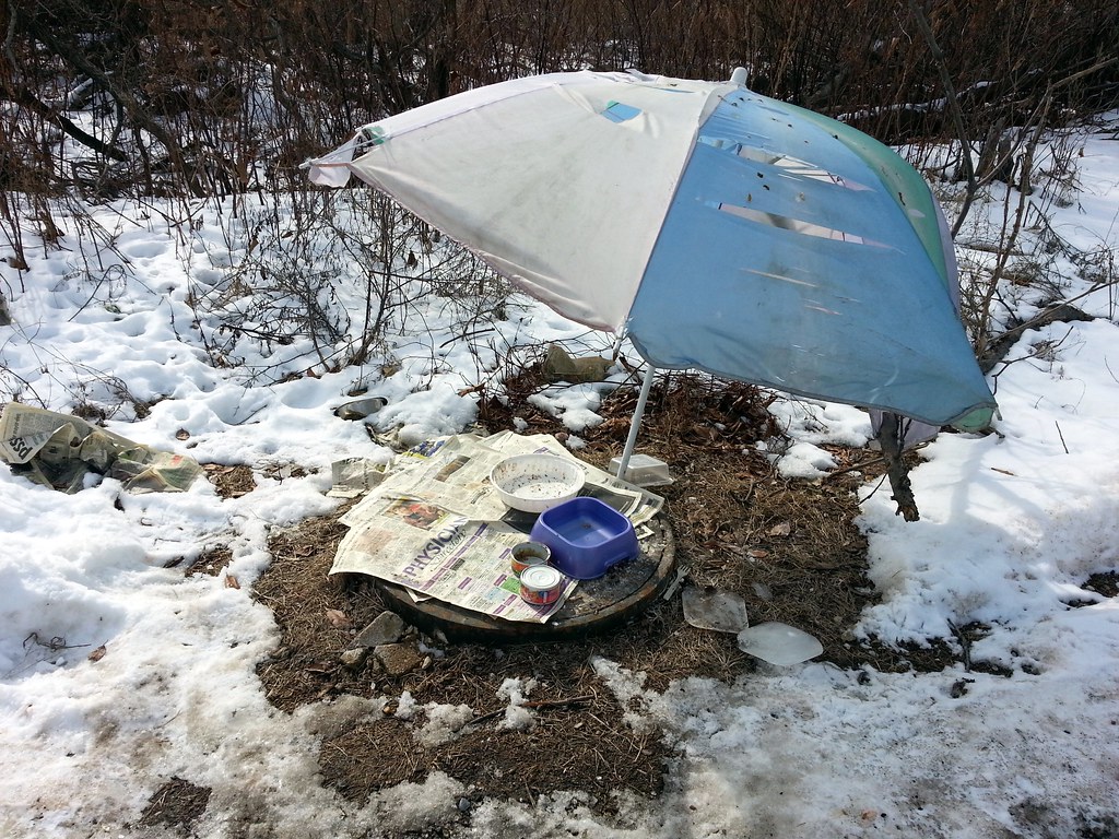
One of several plastic container-top messages on display at this house (as you'll see in the next few photos)
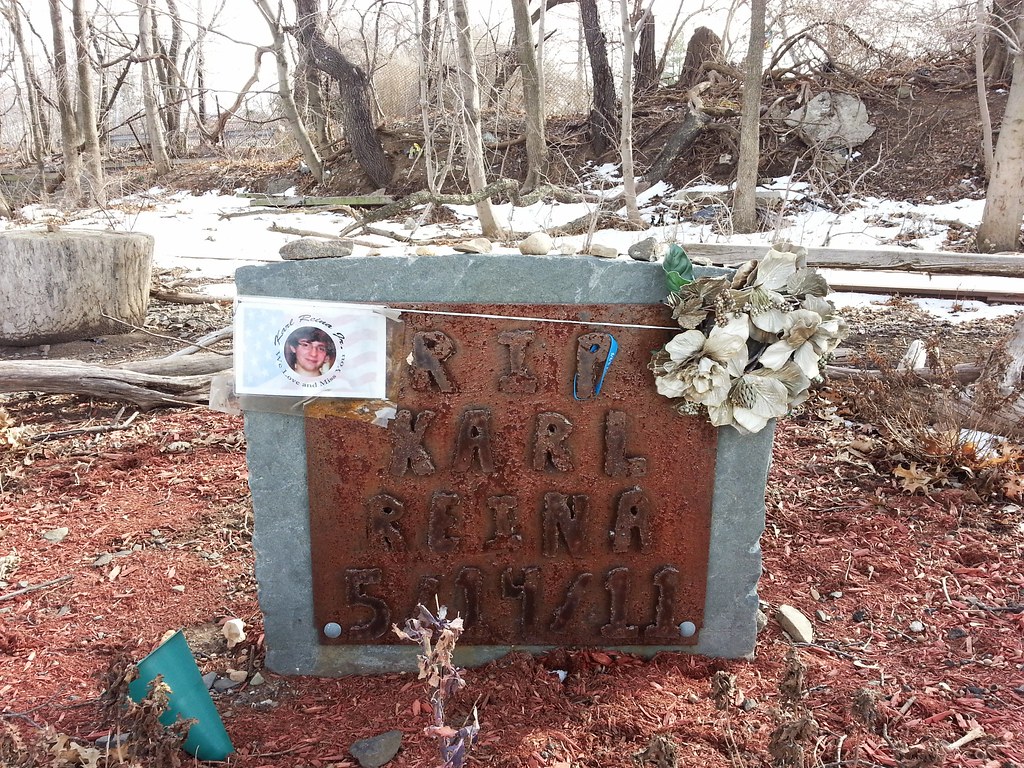
A container-top tribute to the Staten Islanders killed by Hurricane Sandy. I'd guess the "+" refers to a man who wasn't killed directly by the storm, but by falling in a dark, wet hallway after the power went out at his apartment building.
(It's worth zooming in to take a closer look around this place.)
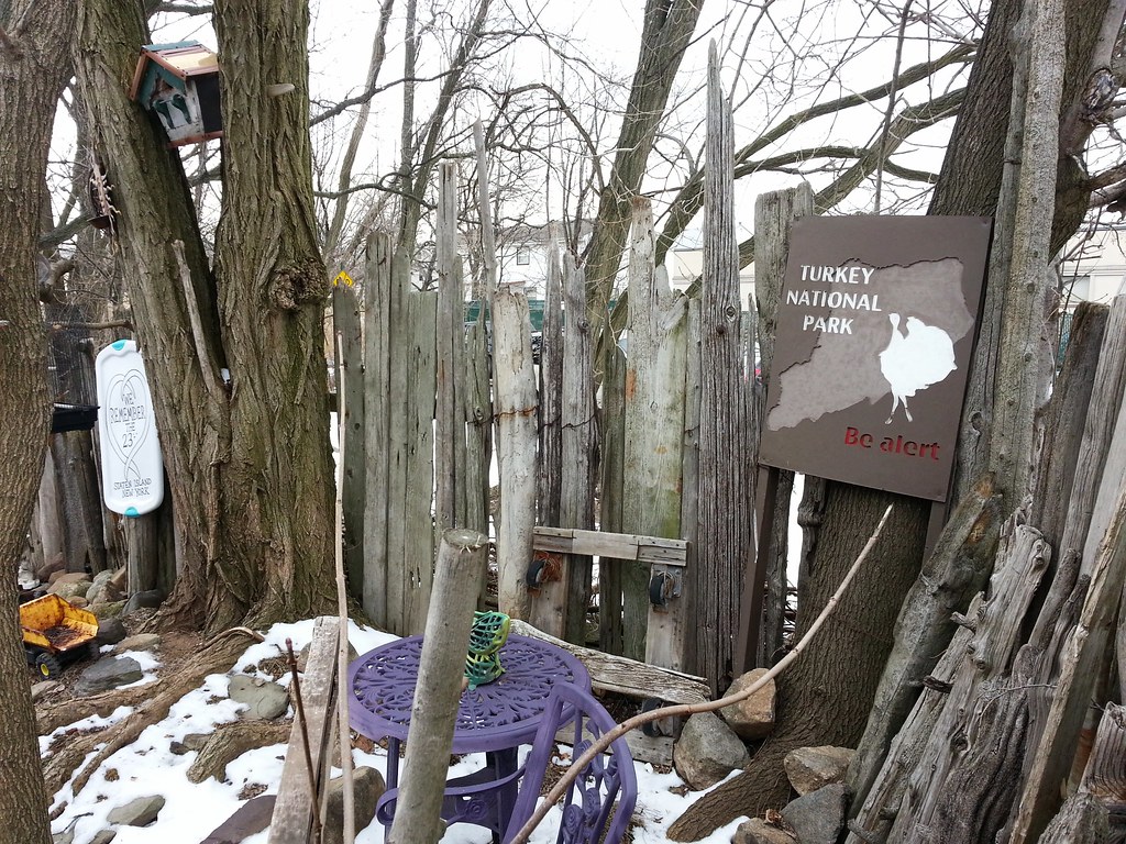
A mock national park celebrating Staten Island's turkeys. It even has a website!

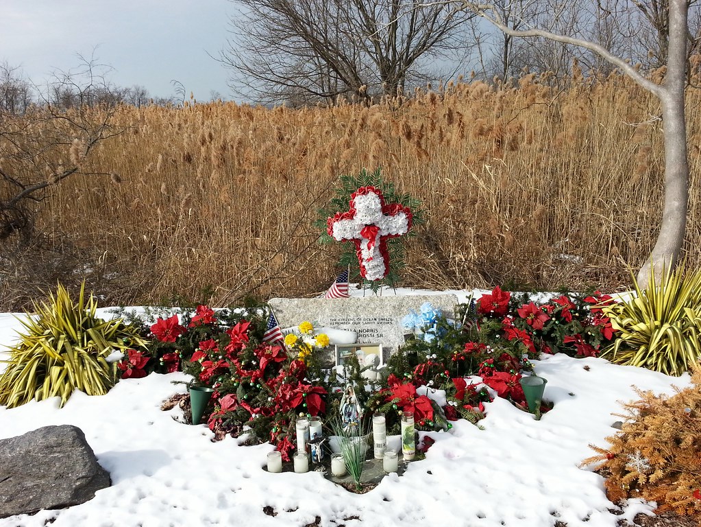
Remembering the two residents of Ocean Breeze killed by the storm
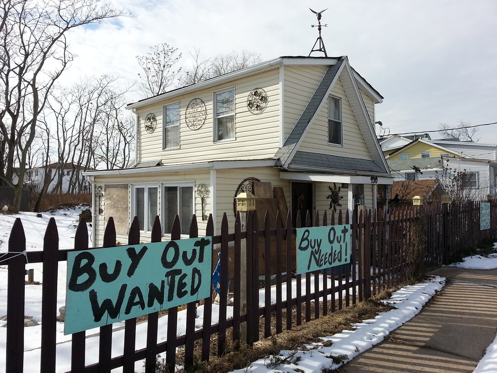
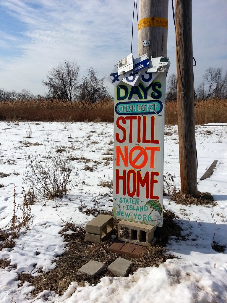
Buy Out Needed!
Buy Out Received!
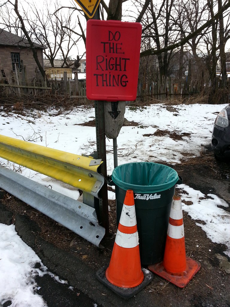
Another one of the several signs posted outside "The Little House in the Gully" reads:
Sandy, Took More(Here's an aerial view of "the Bowl", the area spanning Naughton Avenue to Seaview Avenue and Quincy Avenue to Oceanside Avenue.)
Than Homes, And
Belongings, & Lives
She Took Our Souls
Please Gov. Cuomo
Buy The Bowl
There were once houses standing here. Now there's just that yellow band around the utility pole, marking Sandy's waterline.
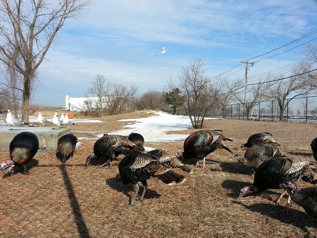
They've all come running across the field (if you zoom in, you can see a few stragglers off in the background by the pine tree) because the guy standing next to me started throwing handfuls of corn kernels over the fence. He told me he doesn't live around here, but whenever he knows he'll be in the area, "I bring my corn."


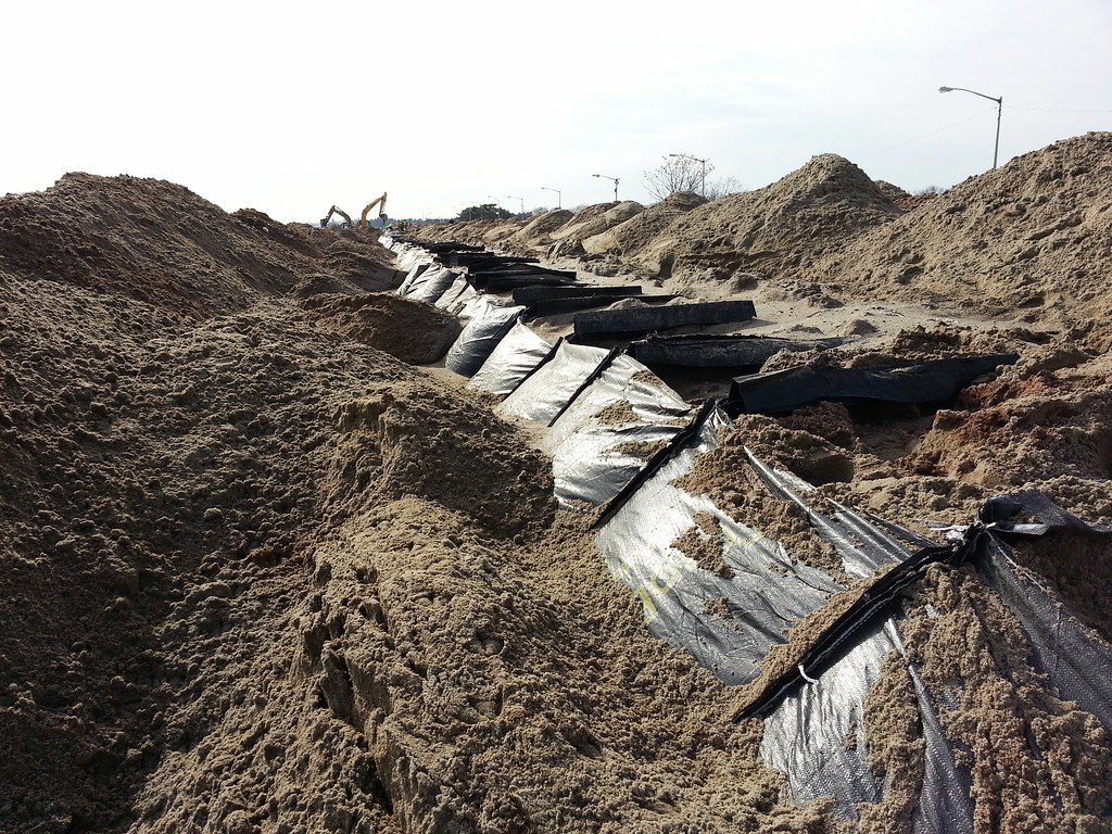
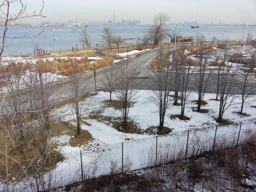
This gap provides passage through the massive protective sand berm taking shape on the beach here in Staten Island.

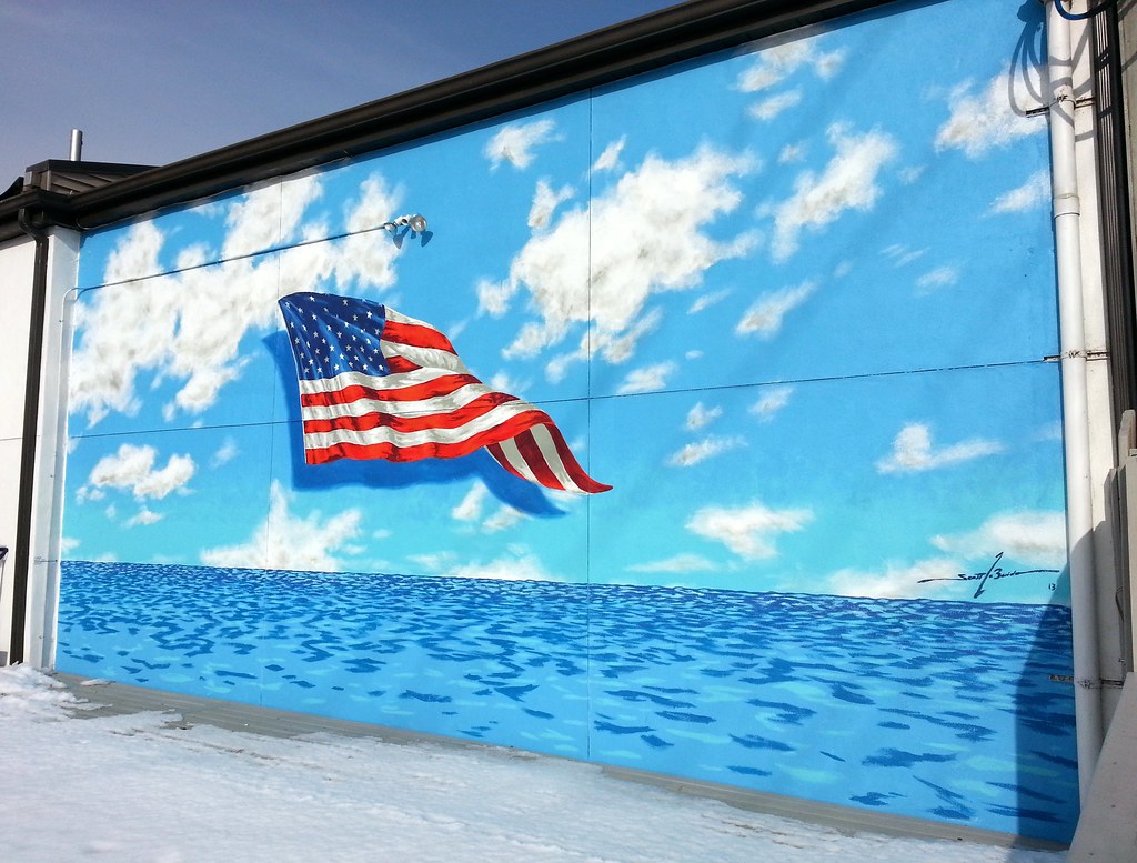
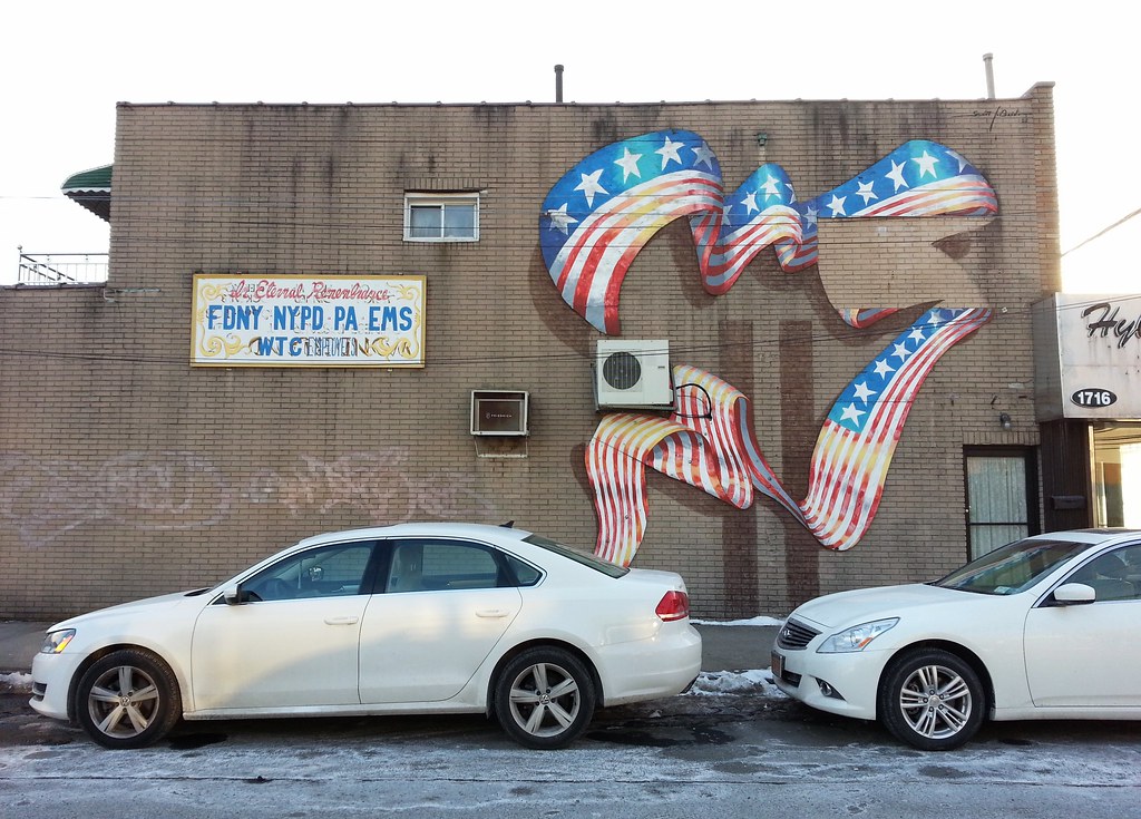
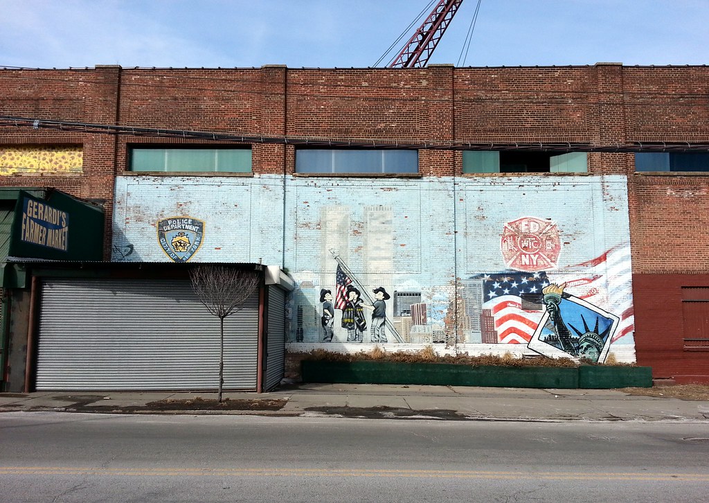
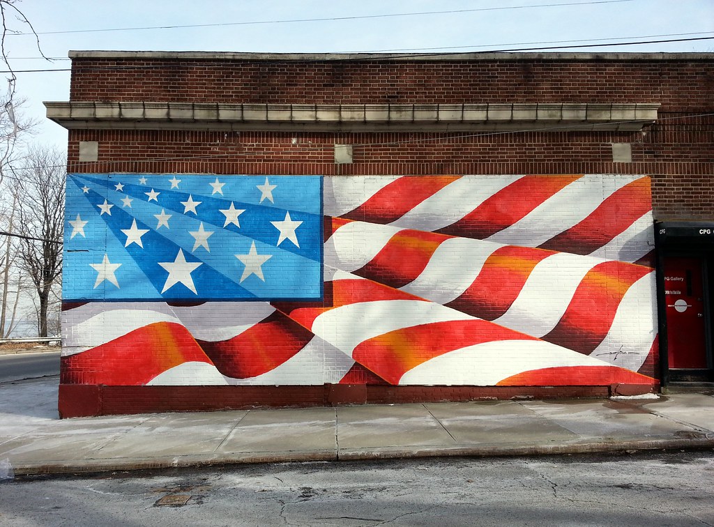
by Scott LoBaido, this one on the side of the rebuilt Toto's restaurant. The painted water level denotes the height of floodwaters during Hurricane Sandy. (The mural is well above ground level; I had to climb up a bit to take this shot over the surrounding railing.)
Standing on Staten Island's North Shore Esplanade, you can see, from left to right, the skylines of Jersey City, Midtown Manhattan (farther away and kind of hazy), Lower Manhattan, and Downtown Brooklyn.
Roughly in the center of the photo, on the New Jersey side of the Kill van Kull, hovering up above the big cylindrical tanks that occupy much of southeastern Bayonne, there's what looks to be a lighthouse. (You can see it more clearly if you zoom in.) I first noticed it a few years ago and just assumed it was a lighthouse, but I never remembered to sit down at my computer and find out for sure.
As impossible as it seems, especially from this angle, it's actually the clubhouse of the $100 million-plus Bayonne Golf Club, a 130-acre Scottish links-style course built atop "a 38-acre municipal landfill and a tract formerly owned by PSE&G that was once considered for a nuclear power plant." (You can see some great shots of the place in this stupid promotional video.) Sited on the waters of Upper New York Bay, amid the industrial landscape of eastern Bayonne (satellite view; bird's-eye view) but only five miles from Wall Street, it's one of the most expensive golf courses ever built, constructed out of 700,000 cubic yards of harbor dredgings, along with "mountains of construction debris and topsoil". Membership in the club is by invitation only, with an initiation fee somewhere around $200,000.
(About two miles farther north along the Hudson County waterfront, even closer to Manhattan, is Liberty National Golf Course, another ultra-exclusive course built on a brownfield. Liberty National opened in 2006, the same year as Bayonne; it was even more expensive to build and costs even more to join.)
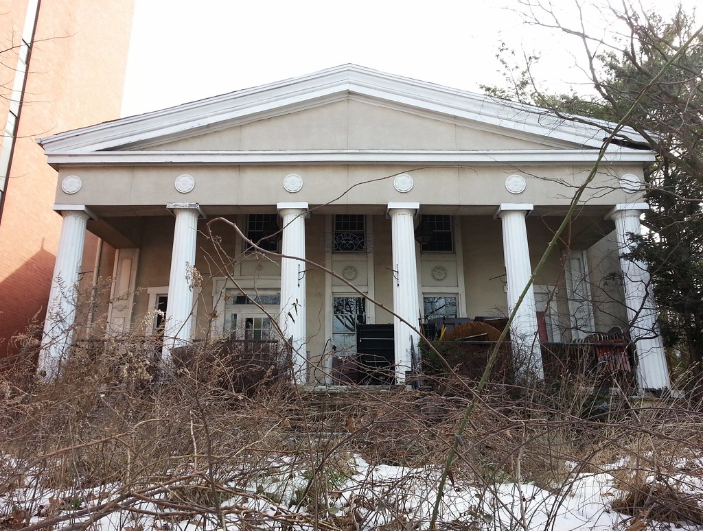
Erected in 1835, this is the last remnant of Temple Row, a series of "early 19th-century Greek Revival mansions built by wealthy New Yorkers and Southern planters along Richmond Terrace when the view across the Kill Van Kull was more pastoral." Until fairly recently, the building was being used as a catering hall named Pavilion on the Terrace. It was run by a Czech immigrant who installed, much to the chagrin of preservationists, a "remarkable sinuous, petaled fence" (photo) along the front of the property, and decorated the ballroom with "a large mural of the Milky Way, busts of Nefertiti, a large canvas backdrop painted to look like a Parisian cafe, and similar touches."
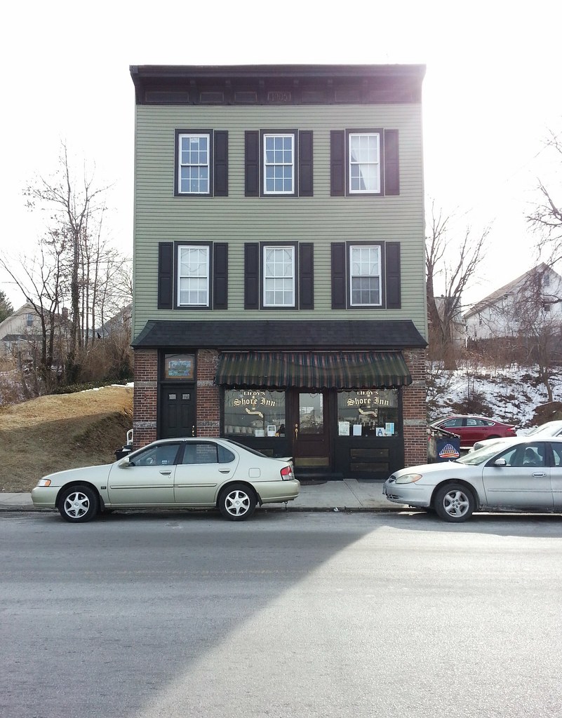
Opened in 1905, Liedy's is Staten Island's oldest bar "in uninterrupted operation by the same family". You can see photos of the interior here.
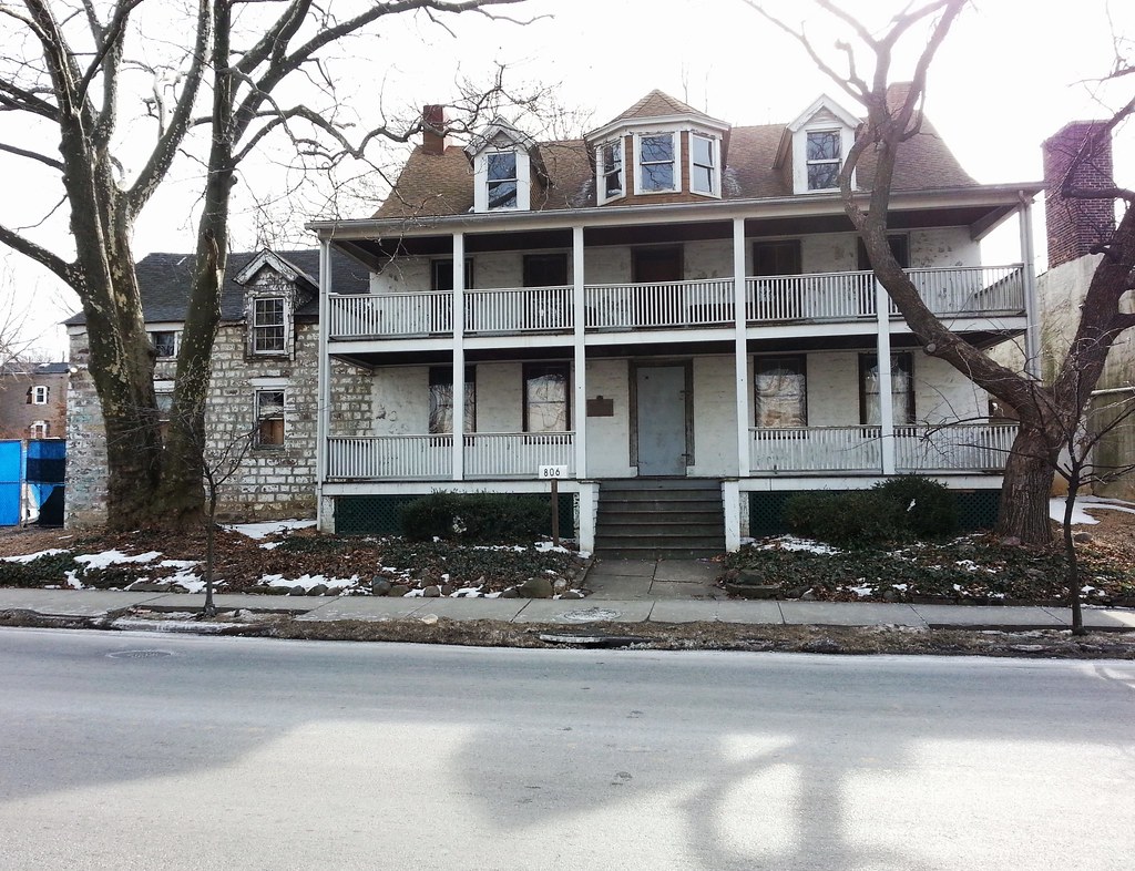
The plaque on the porch from the city's Landmarks Preservation Commission states that this house was built around 1770 and is "one of the few large Pre-Revolutionary War houses still standing in New York City", but a local historian who has researched the building says it was actually constructed in 1783. For a period in the 1800s, it served as a tavern called "The Old Stone Jug".
The guy who owned the house from 1995 until his death in 2011 worked as a guide at Historic Richmond Town, and he restored the house to the look and feel of an earlier era. His only sources of heat were a fireplace and a 19th-century kitchen stove, and he had an 18th-century reflector oven and a spider pan that he used on occasion to cook meals in his fireplace. The current owner was seriously injured when she fell through a rotting floorboard into an old cistern shortly after buying the place in 2012; I'm not sure how she's fared since then.
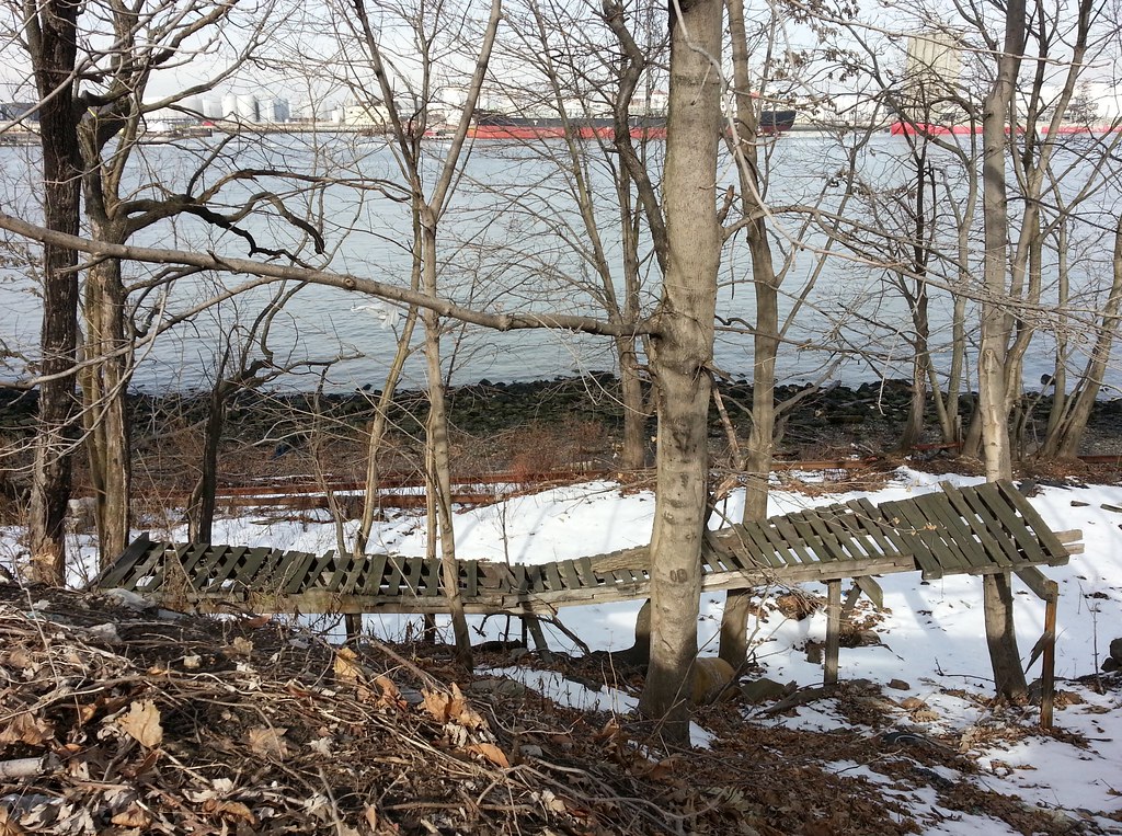
of an elaborate homemade mountain bike course whose wooden structures used to run 150 yards or so alongside the abandoned North Shore branch of the Staten Island Railway (whose rusty rails are visible above), hidden in this thin strip of woods separating Richmond Terrace from the Kill van Kull. The course was still intact just a few years ago; here's a shot I took back in 2008.
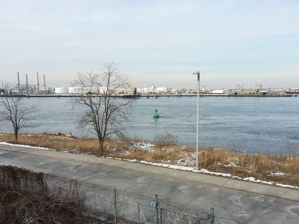
Some 12 percent of all the international shipping containers in the US pass through this unassuming little tidal strait on their way to or from the Port Newark-Elizabeth Marine Terminal.
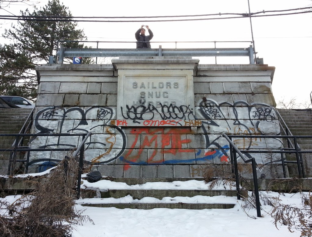
These staircases provide access from the Staten Island Railway's abandoned North Shore branch up to the front entrance of the former Sailors' Snug Harbor, a longtime home for retired seamen whose beautiful buildings and grounds have become today's Snug Harbor Cultural Center & Botanical Garden.
He seems pretty obnoxious, but the man does paint a mean American flag.
The former Sailors' Snug Harbor, a home for "aged, decrepit and worn-out sailors", owes its existence to Robert Richard Randall, an 18th-century merchant turned gentleman farmer. According to a 1912 NY Times piece, a dying Randall "had maintained a lifelong prejudice against lawyers, but with only a few hours [days, actually] left to him he had sent for one of the detested quill drivers to draw his will." The year was 1801, and that quill driver, legend has it, was Alexander Hamilton. Because Randall had inherited his wealth from his father Thomas, "America's best known privateer", Hamilton suggested it would be fitting for the bachelor to dedicate the land he owned "to the relief of unfortunate and disabled seamen".
By the time various legal challenges to Randall's will had been resolved in 1830, the 21 acres of Greenwich Village farmland that he had owned, and where he had envisioned Snug Harbor being built, were rapidly becoming more valuable as the city expanded northward. The Snug Harbor trustees decided it would be wise to locate the institution elsewhere and support it with rental income from the land in Greenwich Village. Considering "the habits and character of seamen", the trustees "feared that the heart of the city would offer too many temptations to Randall's sea dog wards."
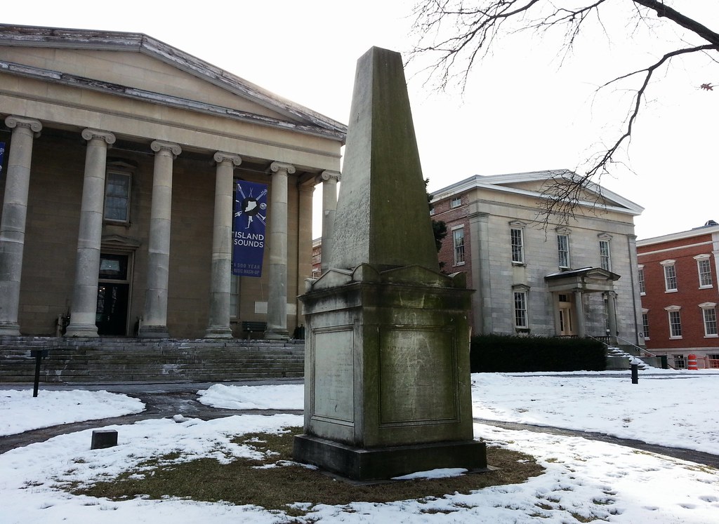
So Snug Harbor was instead established on the north shore of Staten Island, overlooking the waters of the Kill van Kull. The former dormitory/administration building at left, now known as Building C, stood alone when the institution opened its doors in 1833, but it was gradually joined by many other architecturally distinguished structures and is now "the centerpiece of one of the most notable groups of Greek Revival buildings in the United States". (Here's a bird's-eye view of Snug Harbor to help you get a sense of the place.) The obelisk above marks the spot where Randall's remains were reinterred in 1834 after being exhumed from his original grave in Manhattan.
At its peak, Snug Harbor housed "nearly 1,000 ancient salts, who were left to live out their lives pretty much undisturbed, as long as they didn't get drunk and disturb the peace -- which, some accounts say, they did with some frequency." The institution's coffers were stuffed with income from its Greenwich Village holdings; a 1922 NY Times article called it "the richest charitable institution in New York". By the mid-20th century, however, Snug Harbor had fallen into decline, with its residents dwindling in number and its financial resources diminishing.
In the early 1950s, the trustees tore down several buildings, including the magnificent Randall Memorial Chapel, and in the 1960s they proposed "large-scale demolition and high-rise construction" on the grounds. But in 1965, the city's nascent Landmarks Preservation Commission stepped in and designated six of the most significant remaining buildings as landmarks, protecting them from destruction. Unable to maintain the deteriorating structures, the trustees decided to relocate the sailors' home to North Carolina in the 1970s, and they sold the Staten Island property to the city, which has gradually developed it into today's Snug Harbor Cultural Center & Botanical Garden. We'll spend most of the rest of the day walking around the grounds here and learning a little bit more about the place.
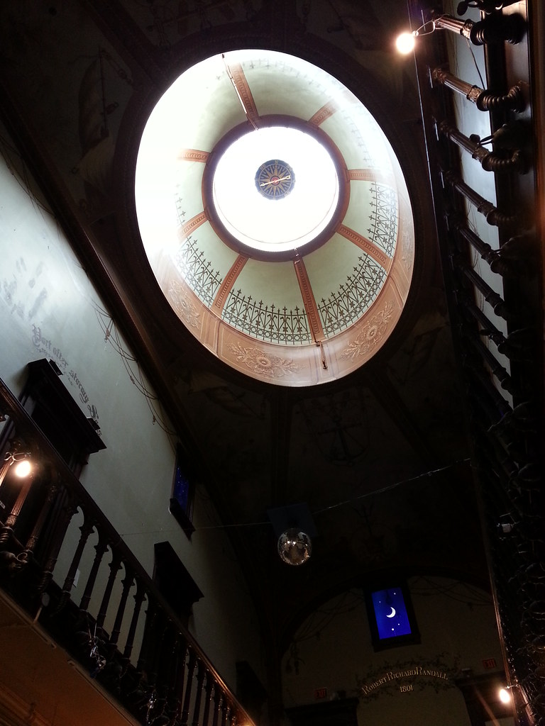
inside Building C. Opened in 1833, this was the first Snug Harbor building.
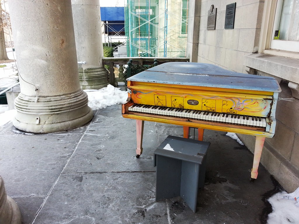
A survivor from the summertime Sing for Hope Pianos project
Completed in 1879, this former dormitory is the westernmost of the five imposing Greek Revival structures on Snug Harbor's front line, all of which were built as residences for the retired sailors who lived at the institution. Building A is currently being transformed into a new home for the Staten Island Museum. (The museum, as we've learned, has the world's second-largest collection of cicadas!)
This Anglo-Italianate structure was originally a chapel, as you can probably tell. According to Snug Harbor's website, all the retired sailors living at the institution were required to attend religious services, and after the Veteran’s Memorial Hall opened in 1856, the pastor addressed his flock thus:
You are here, however, not to spend your time in idleness, in the mere animal indulgence of eating, and drinking, and sleeping; but you are here to refit. Your voyage has not yet terminated; the most important part of it is yet before you; there are quicksands, concealed rocks, whirlpools, and yawning gulphs. There may be a darker, severer, and more terrific storm, and a more awful warring of the elements still in reserve for you, than any through which you have ever passed — you may yet be hopelessly wrecked, and left to sink into the deep and unfathomable abyss. Have you prepared your bark for this last part of your voyage, and are you sure all is right?
Erected in 1880, this house was the residence of Snug Harbor's governors, one of whom, serving from 1867 to 1884, was Herman Melville's brother, Thomas.
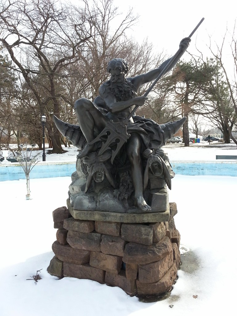
Dedicated in 1994, this is a bronze replica of the original (now on view at the visitor's center in Building C), which had been cast in zinc and painted bronze to save money when it was created a century earlier.
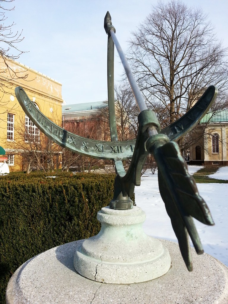
The arrow (gnomon) of this equatorial bow sundial should be oriented due north (parallel to the earth's rotational axis), but it's angled perhaps 80 degrees to the east.
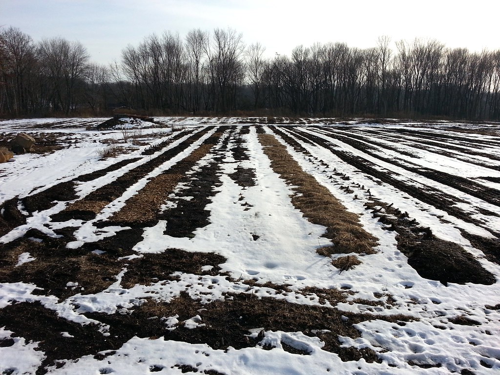
In its heyday, Sailors' Snug Harbor was a self-sufficient institution, raising its own livestock and maintaining a four-acre vegetable/fruit farm (photos). In the last couple of years, the modern-day Snug Harbor Cultural Center & Botanical Garden has decided to bring back the farm, cultivating two acres that are used for both food production and agricultural education.

