
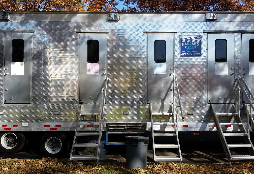
Lucy and Desi? Turns out they're discreetly labeled bathrooms!
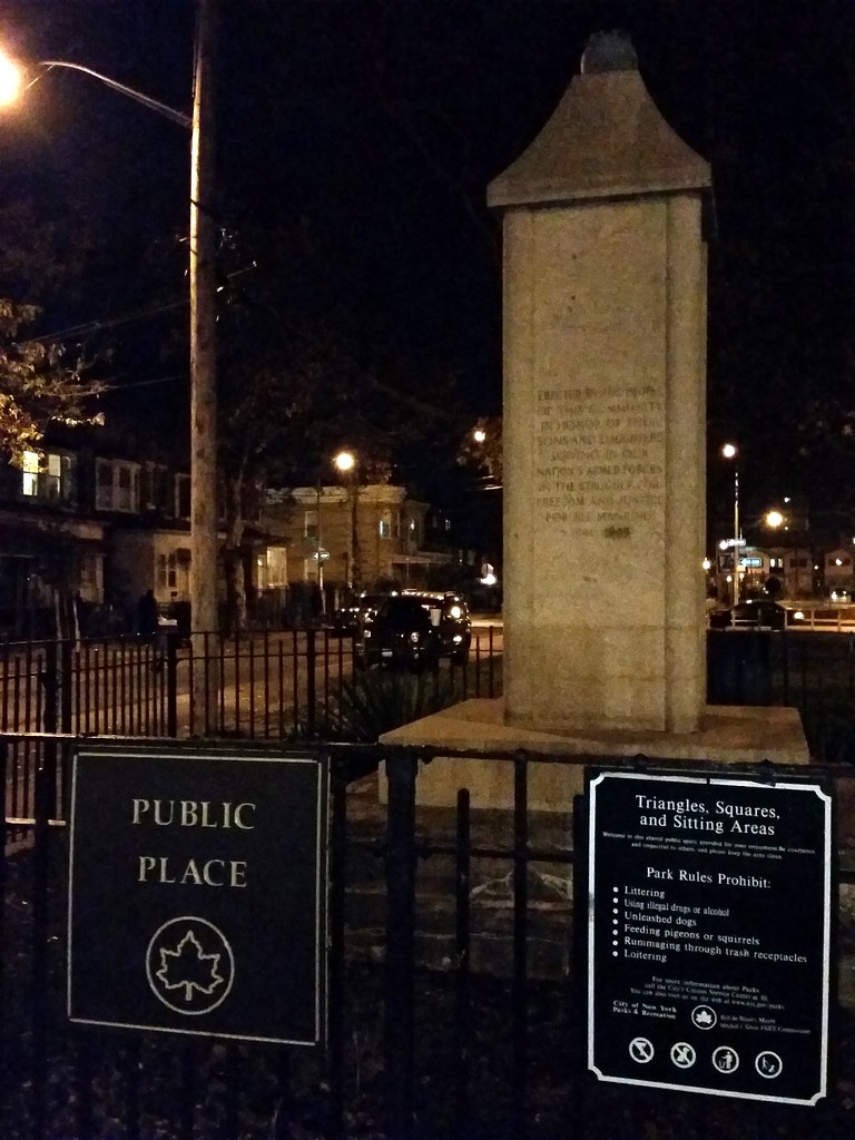
This little parklet looks much more welcoming than the last such Place we saw. Apparently, there was originally a bronze eagle on the World War II memorial above. It must have been either stolen or damaged, but I'm guessing those are its talons still perched atop the monument.
(The wildly imaginative name of this public place brings to mind the string of Parks found along the Prospect Expressway.)
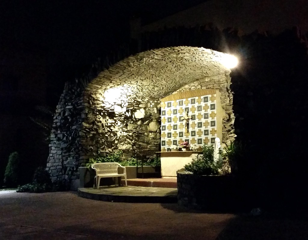
at the Church of St. Sylvester. Check it out in the daylight.

Three Obama-inspired business names in one day? (Here are the other two.) Prior to today, during the entire course of this walking project, I had only come across three other establishments named for our current president. (I previously said I had only come across two, but I had forgotten about the most explicit one of all.) Obama Deli & Grill had already either been renamed or gone out of business when I passed by. Obama Fried Chicken has gone out of business since I passed by. And Barack Hussein Obama Children Center, it seems*, may never have gone into business in the first place (although its awning was still up when the Street View car drove by in October). So it's entirely possible that most or even all of the active businesses in the city named for the president are located here in Cypress Hills, on or just off of Fulton Street, within seven blocks of each other. Weird!
(FYI, King Barack opened up shop sometime between August 2011 and September 2013.)
* The NY Post article linked above makes Sheikh Moussa Drammeh ("Sheikh" is his first name, not a title, and is misspelled in that article), a Bronx imam, sound like a sleazeball and/or nutcase.** But from what I've read, he's a well-respected, positive force in his community of Parkchester. In fact, the Post itself honored him with one of its annual Liberty Medals back in 2007. He founded the Islamic Leadership School — the Bronx's only Islamic school — which, in a bizarre coincidence, opened on September 11, 2001. His latest community venture is a neighborhood "peace patrol" that aims to help troubled kids before they turn to crime.
He's also twice been in the news for his generosity to other religious organizations. In 2004, when the Interfaith Center of New York, led by a former dean of the Cathedral of St. John the Divine, was unable to make rent on the Midtown Manhattan space it had called home for five years, Mr. Drammeh gave the group office space in the Bronx free of charge, in the same building that's now home to, among other things, his mosque, his school, and the apparently never-opened Barack Hussein Obama Children Center.
In 2008, when a tiny, aging Jewish congregation in the neighborhood found itself without a home, Mr. Drammeh offered up space in his mosque, rent-free, saying "I’m paying back. I am an immigrant, from Africa. I came here to New York and all the religious freedoms and acceptance, I don’t have to fight for it, the Catholic and Jewish communities already fought, and now it’s for my behalf. It would be very ungrateful if I don’t play any role, especially for the older folk, so they can benefit in turn from my being here. It is my time to say, let me [pay back] at least a little bit for the neighborhood you made and the work you have done." As far as I can tell, the congregation is still in existence and is still meeting in the mosque.
There's also a pedestrian aspect to this story. When the congregation was on the brink of collapse, shortly before Mr. Drammeh's offer, it was taken over by young Chabad rabbis and rabbinical students who had responded to the elderly Jews' requests for help. Forbidden from traveling by motorized vehicle or bicycle on the Sabbath, the Chabadniks began regularly walking the 15 miles from their homes in Crown Heights, Brooklyn to the mosque on Saturday mornings to lead services. (Nerd note: the route mentioned in the article is over 16 miles long.)
** I should note that the Post was correct about Mr. Drammeh inventing what it called a bathroom-sink alarm. In 2013, he was issued US Patent No: 8,344,893 for a "hygienic assurance system" that uses a "plurality of sensors" and a "plurality of visual and audible signals", as well as a camera, to remind people (presumably employees) to wash their hands after using the toilet and to ensure that those who don't wash up properly, "for an adequate time span", can be identified "for later reprimanding . . . by the facilities owner or hygiene enforcer." But I have some good news for those of you who hate washing your hands. I've looked over the patent and found a loophole. Flushing is the action that triggers the system into thinking you need to wash up, so all you have to do is not flush!
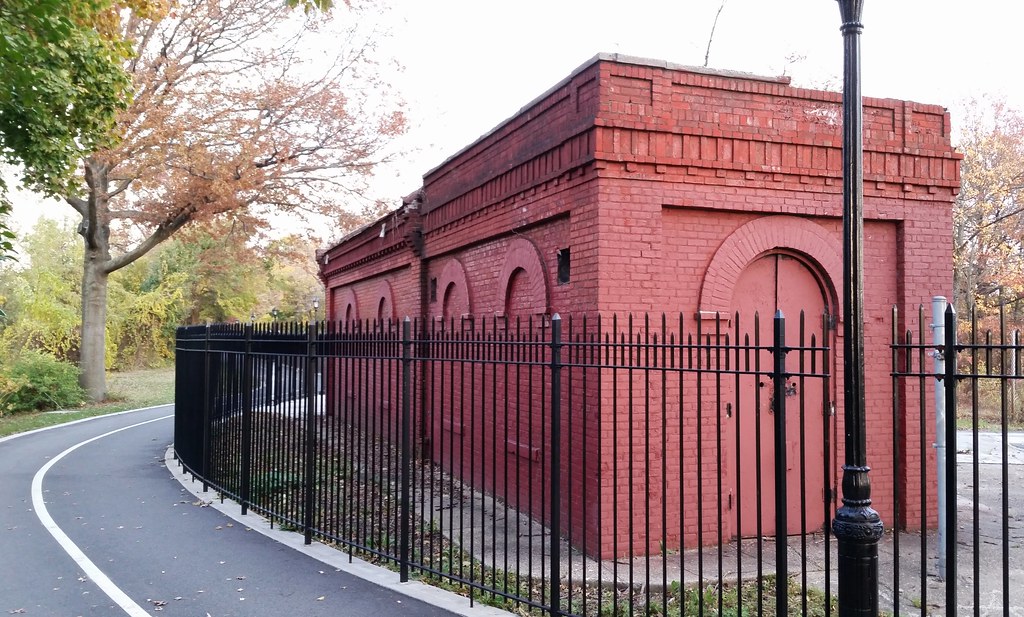
Located at the northern end of the Ridgewood Reservoir, between the two original basins that went into operation in 1858, this building stands atop the sluice gates that controlled the amount of water leaving those basins. The water would pass through the sluices into an effluent chamber, where it would enter the pipes of the distribution system and be carried down to the people of Brooklyn.
From Brooklyn Water Works and Sewers: A Descriptive Memoir, written by the chief engineer in charge of the reservoir's construction:
The water space of the effluent chamber is connected by passages eleven feet wide, with the two divisions of the reservoir. A heavy granite wall is built across each passage, rising to the same level as the top of the reservoir banks. In each wall there are four openings, the two lower openings being 3x3 each, and the two upper openings 3x4 each. Iron sluices running in iron slides, faced with composition metal, cover and control these openings. From these sluices, iron rods of two inches diameter rise to the top of the work, where they terminate in screws and gearing for the movement of these sluices. [Two hand-wheels for controlling the sluice gates can still be found behind the gatehouse.] . . .
In front of the sluices, towards the reservoir, in each passage, copper wire screens are placed, twenty-two feet in height, to prevent fish, leaves, &c., from passing into the effluent chamber, and so into the supply pipes. . . .
The apparatus for moving the sluices is protected by a small house built over each passage.

of the Ridgewood Reservoir. Here's the description of this section of the basin from a 2005 Parks Department survey of the reservoir:
Black locust and mugwort dominate throughout this area. Other species found are: buckthorn, Phragmites, goldenrod, bush honeysuckle, bigtooth aspen, grey birch, quaking aspen, Royal Paulownia, Japanese knotweed, white snakeroot, smartweed, poison ivy, bittersweet nightshade, oriental bittersweet, and cottonwood. A great deal of bird activity was observed in this unit.

Starting in the 1850s, to meet the needs of its rapidly growing population, the then-independent city of Brooklyn constructed the Ridgewood Reservoir (old photos) just over the county line in Queens, atop the Harbor Hill Moraine in what is now Highland Park, and built an aqueduct system to supply it with water from a series of dammed streams and wells located farther east on Long Island, in today's Queens and Nassau Counties. (As we recently learned, the water flowed west through the eponymous conduits of Conduit Avenue/Boulevard and was pumped up to the reservoir through the eponymous force tubes of Force Tube Avenue.) Over time, more water sources were incorporated into the system, and the reservoir grew as well: a third basin was completed in 1891, doubling the total capacity to some 300 million gallons.
Brooklyn became part of New York City in 1898. With the development of the city's two vast Catskill Mountain aqueduct systems (the Catskill and Delaware Aqueducts) in the early and mid-1900s, the Long Island water supply became less and less important. The water from the Catskills, in addition to being much more plentiful, was also cheaper to transport: unlike the Long Island water, which required pumping, it originated at a high enough elevation to reach the city under the force of gravity alone. Thus, the Long Island water was used only when the city's demand exceeded the capacity of its gravity-powered upstate aqueducts (the Catskill systems plus the older Croton and Bronx/Byram systems). The Ridgewood Reservoir, while maintaining its connection to the Long Island supply, also began receiving Catskill water. It continued to function as a distributing reservoir until about 1959, after which it was used only as a backup supply. It was finally taken out of service altogether sometime around 1985 or 1989.
Over the years, the reservoir's three basins, covering some 50 acres, have been slowly reclaimed by nature.* The center basin, above, contains a pond surrounded by phragmites, the invasive, ubiquitous reed found in wetlands all over the city. The east and west basins, on the other hand, are "filled and completely vegetated", and are home to "closed forest, scrub, woodland, and vineland" habitats, according to the Parks Department. For more specifics, check out this detailed survey of plant life in the reservoir.
In 2007, it came out that the Parks Department was leaning toward leveling the forest in the largest (west) basin and building new athletic fields there. This caused an uproar among environmentalists and many local residents, who argued that the reservoir's wildness is a precious resource that needs to be preserved and that Parks should renovate the existing ball fields in the adjacent areas of Highland Park instead of building new ones inside the reservoir. After taking a tour of the reservoir in 2008 and seeing its charms firsthand, Bill Thompson, then the city's comptroller, co-authored an NY Times op-ed arguing against the destruction of the forest, and, a month later, rejected a Parks Department contract to build athletic fields in the basin.
In 2009, Thompson approved a contract to fix up the walking paths and other perimeter features at the reservoir, work that was completed in October 2013. The contract also specified that three conceptual plans for the overall development of the reservoir, including one design for passive recreation, would have to be created and submitted to the public for feedback before the project could go ahead. Although there's currently no funding lined up for future work at the reservoir, the three designs were presented to the public in June 2013. To describe them briefly: one would allow access only to the west basin, where walking trails would be built; one would provide for light recreation in each basin; and one would involve the additional construction of baseball fields, a comfort station, and a "waterworks-themed adventure playground" in the west basin.
Just this past summer, it looked like the reservoir was facing another threat from the Parks Department. Parks officials were talking about starting work by August on a $6 million project that would involve breaching the inner and outer walls of the reservoir in order to install culverts. Additionally, a gravel roadway would be built between the three culverts for construction and maintenance vehicles to use. The purpose of this work was to bring the reservoir into compliance with State Department of Environmental Conservation (DEC) regulations (although some suspected that Parks might be going through with the project as a sly way to lay the groundwork for future development of the reservoir). Basically, the DEC has classified the reservoir as a Class "C" or "High Hazard" dam. The city obviously doesn't want to have to maintain a defunct reservoir as if it were an active dam, so it needs to get the reservoir reclassified as a Class "A"/"Low Hazard" or Class "D"/"Negligible or No Hazard" dam. The culverts would lower the hazard level by allowing any water that gathers in the reservoir to flow out before it reaches a potentially dangerous volume.
Of course, a much simpler way to get the reservoir reclassified would be to ask the DEC to change its classification. But would that be appropriate in this case? Well, the state defines a high hazard dam as a dam whose failure "may result in widespread or serious damage to home(s); damage to main highways, industrial or commercial buildings, railroads, and/or important utilities, including water supply, sewage treatment, fuel, power, cable or telephone infrastructure; or substantial environmental damage; such that the loss of human life or widespread substantial economic loss is likely."
If that strikes you as a ridiculous description of a mostly empty reservoir, you're not alone. But it was only after community members and elected officials raised a ruckus that Parks decided to hold off on the culvert plan and apply to the DEC for reclassification instead. As far as I know, nothing's been approved yet, but the DEC commissioner seemed amenable to the idea in a letter to the aforementioned elected officials.
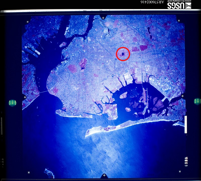
* It's difficult to tell when each of the basins was abandoned. In my research, I repeatedly came across the claim that only one of the three basins was used during the reservoir's final, post-1959 role as a backup supply, but this is clearly contradicted by some historical aerial photos I found using the USGS's EarthExplorer. Judging from what I see in the photos, the center and west basins were both kept full until at least 1976. By 1984, the west basin looks to have been abandoned and to have started its transition to a more natural state. The center basin still appears to be in use in 1985, but the phragmites invasion was underway by 1994. It looks like the east basin hasn't been used since at least 1959, and so presumably started growing wild much earlier than the other two basins. Just for the sake of thoroughness, and to put everything in one place, here are the relevant aerial photos I was looking at:
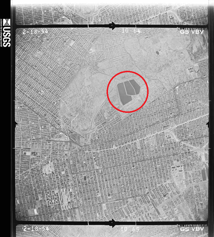
- February 18, 1954: All three basins are full.
- October 30, 1959: From this point on, the east basin looks abandoned in every photo. It contains water at times, but is never full.
- April 29, 1960
- May 5, 1960
- February 23, 1966
- September 15, 1969
- September 23, 1972
- August 30, 1976
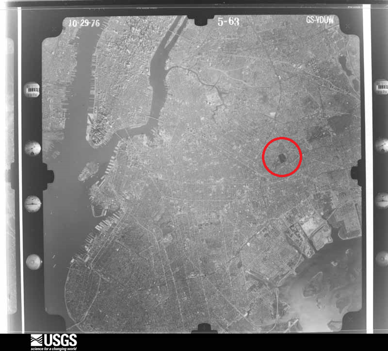
- October 29, 1976
- March 26, 1984: The west basin now appears abandoned.
- March 16, 1985
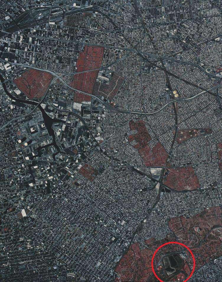
- April 4, 1994: Phragmites can be seen in the center basin. This is the earliest photo I can find in which all three basins are abandoned.
If you're still reading this, you might also be interested in viewing the city's high-resolution aerial images of the reservoir over the years: 1924, 1951, 1996, 2006, 2008, 2010, and 2012.
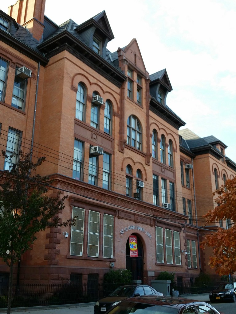
Constructed in 1895, PS 108 (old photos) was designed by James W. Naughton, who was the architect of more than 100 schools during his tenure as Brooklyn's superintendent of school buildings from 1879 to 1898. We've already seen another of his designs today: the 1889 expansion of the former PS 65.
PS 108's secondary name, the Sal Abbracciamento School, honors a longtime neighborhood resident who successfully led the fight to save both PS 108 and PS 65 from demolition in the 1960s.
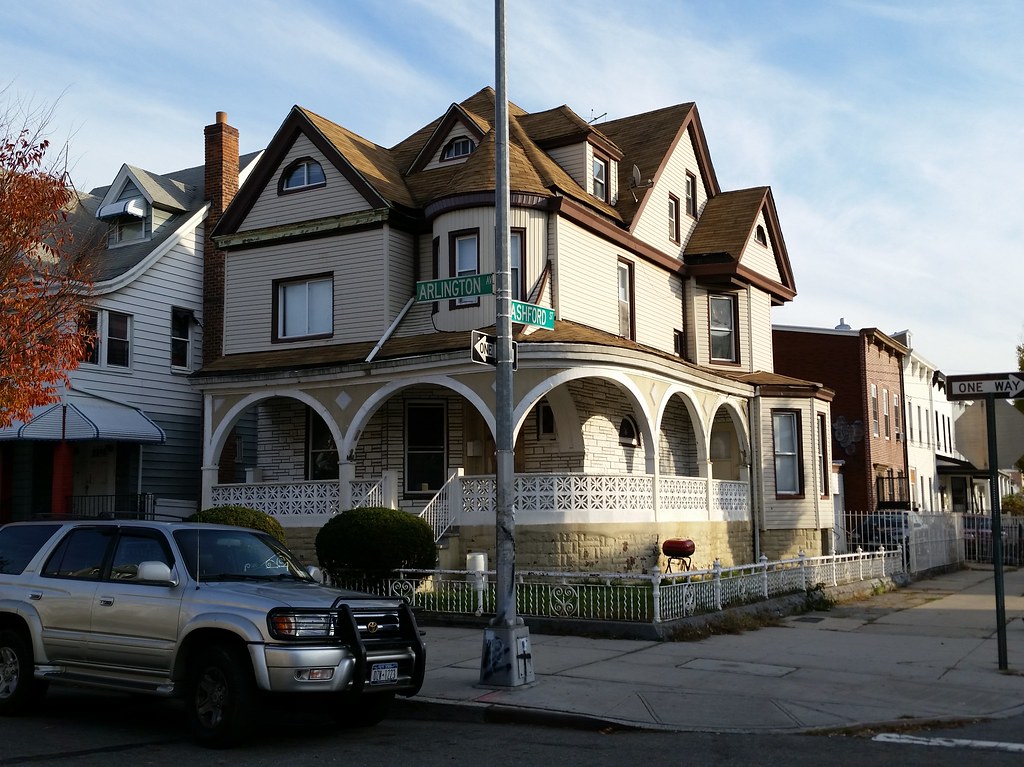
Here's some info about this house, as well as some old photos of it. And here's a little historical tour of this stretch of Arlington Avenue, supposedly once known as "Doctors' Row".
Incidentally, I learned that Arlington Avenue is named for the famous Arlington National Cemetery in Arlington, Virginia. That might seem like an odd source of a name for a street in Brooklyn, but a glance at the map reveals that the eastern end of Arlington Avenue lies just three blocks away from Cypress Hills National Cemetery.
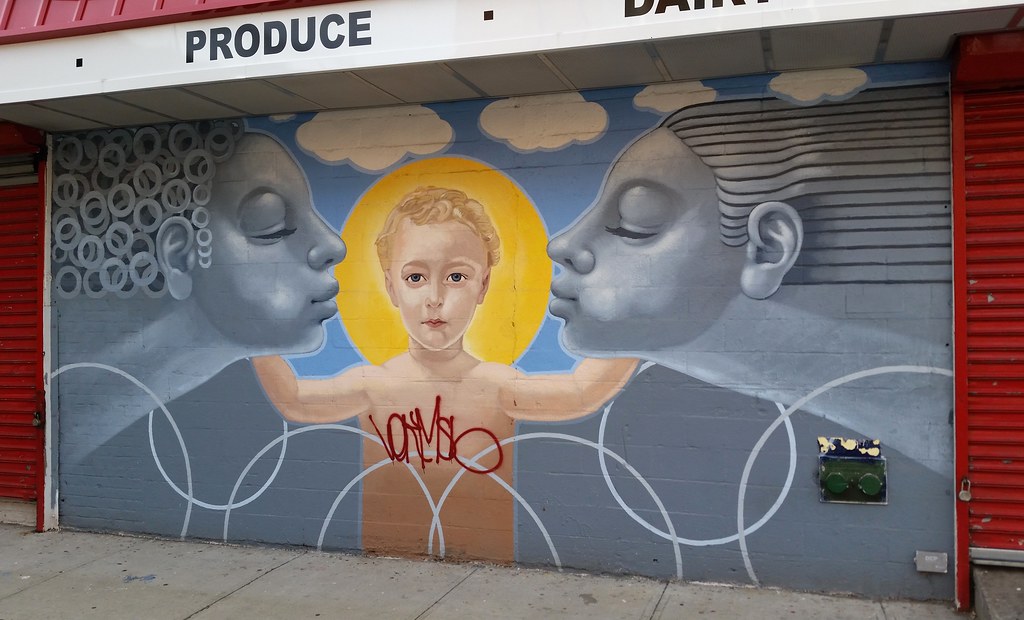
The strangest of the aforementioned C-Town murals
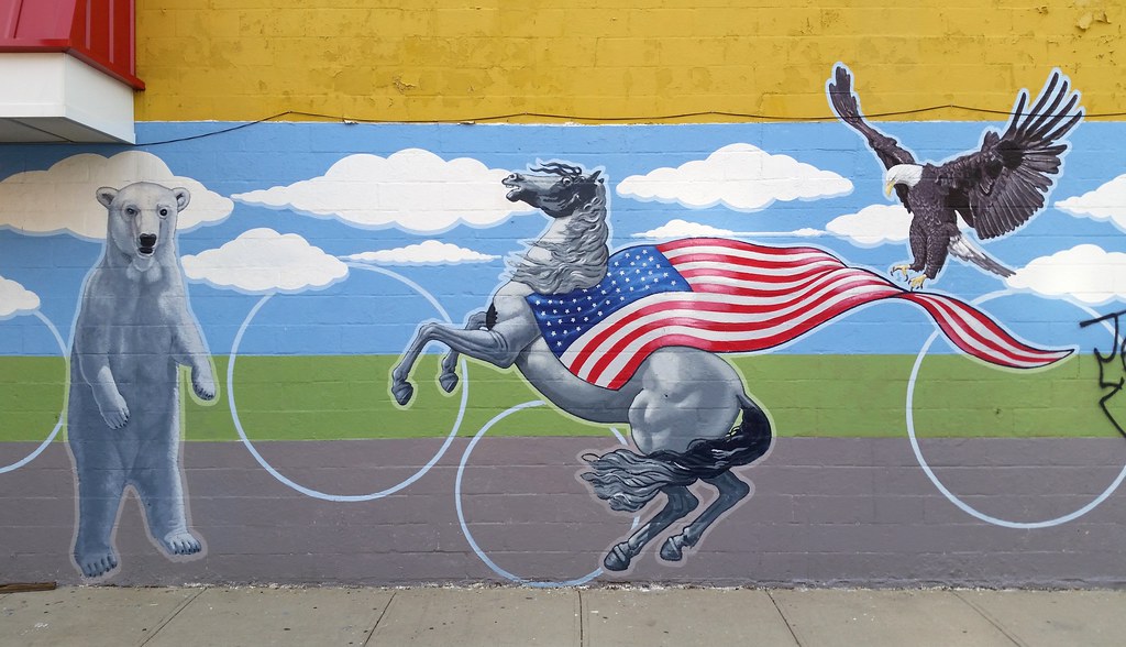
One of a few odd scenes painted on the wall of this C-Town grocery store
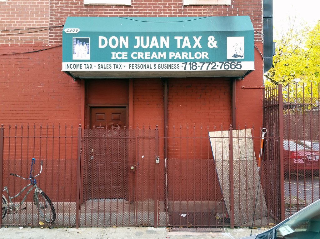
This is either the greatest business or the worst money-laundering front in history.
I'm walking every street in New York City.
This is the counterpoint to my walk across the US. Instead of seeing a million places for just a minute each, I'm going to spend a million minutes exploring just one place. By the time I finish walking every block of every street in all five boroughs, I'll have traveled more than 8,000 miles on foot — all within a single city. Details!
Email me at matt@imjustwalkin.com
Subscribe to my email list
Maps: Progress | Photos

~9,954 miles walked
Your donations allow me to keep walking full-time. If you think what I'm doing is valuable and you'd like to offer some support, I would be very grateful. On the other hand, if you think I'm a worthless bum, feel free to email me and tell me to get a job, bozo. Both are excellent options!
