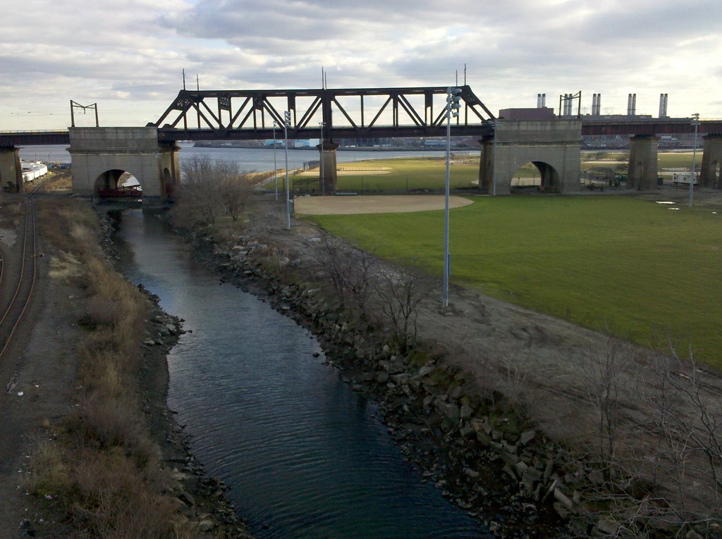
I'm taking this photo from the Bronx span of the Triborough Bridge (officially renamed after RFK a couple of years ago, but still colloquially known as the Triborough), which is actually three different bridges connecting the Bronx, Manhattan, and Queens. You can see the Bronx on the left, separated from Randall's Island (which is part of the borough of Manhattan) by the Bronx Kill. Queens is visible in the background, separated from Randall's Island by Hell Gate (which is the name of that waterway). The bridge we're looking at is part of the Hell Gate complex of railroad bridges and viaducts. You may be wondering why this bridge seems to be largely spanning a ballfield. When it was built, the Bronx Kill was considerably wider, but has since been narrowed by the addition of landfill to Randall's Island. In fact, the name "Randall's Island" is actually something of a misnomer, as it is connected by landfill to Wards Island, which used to be a separate island lying to the south.
I'm walking every street in New York City.
This is the counterpoint to my walk across the US. Instead of seeing a million places for just a minute each, I'm going to spend a million minutes exploring just one place. By the time I finish walking every block of every street in all five boroughs, I'll have traveled more than 8,000 miles on foot — all within a single city. Details!
Email me at matt@imjustwalkin.com
Subscribe to my email list
Maps: Progress | Photos
Your donations allow me to keep walking full-time. If you think what I'm doing is valuable and you'd like to offer some support, I would be very grateful. On the other hand, if you think I'm a worthless bum, feel free to email me and tell me to get a job, bozo. Both are excellent options!


Wow yeah, that is information overload. I had to read it twice, real slow the second time, to understand it all and see what’s where. Basically, the river used to be wider, but it’s filled in with a bunch of garbage now that people play on top of, right? And you can see Queens in the background along with some other stuff. Gotcha.
Hmmm Hell’s gate …but does not lead to Hell’s kitchen…..Randal’s Island has the circus from time to time.
Yea this a cool area to just look out and wonder/see all the connections.