
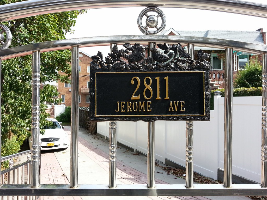
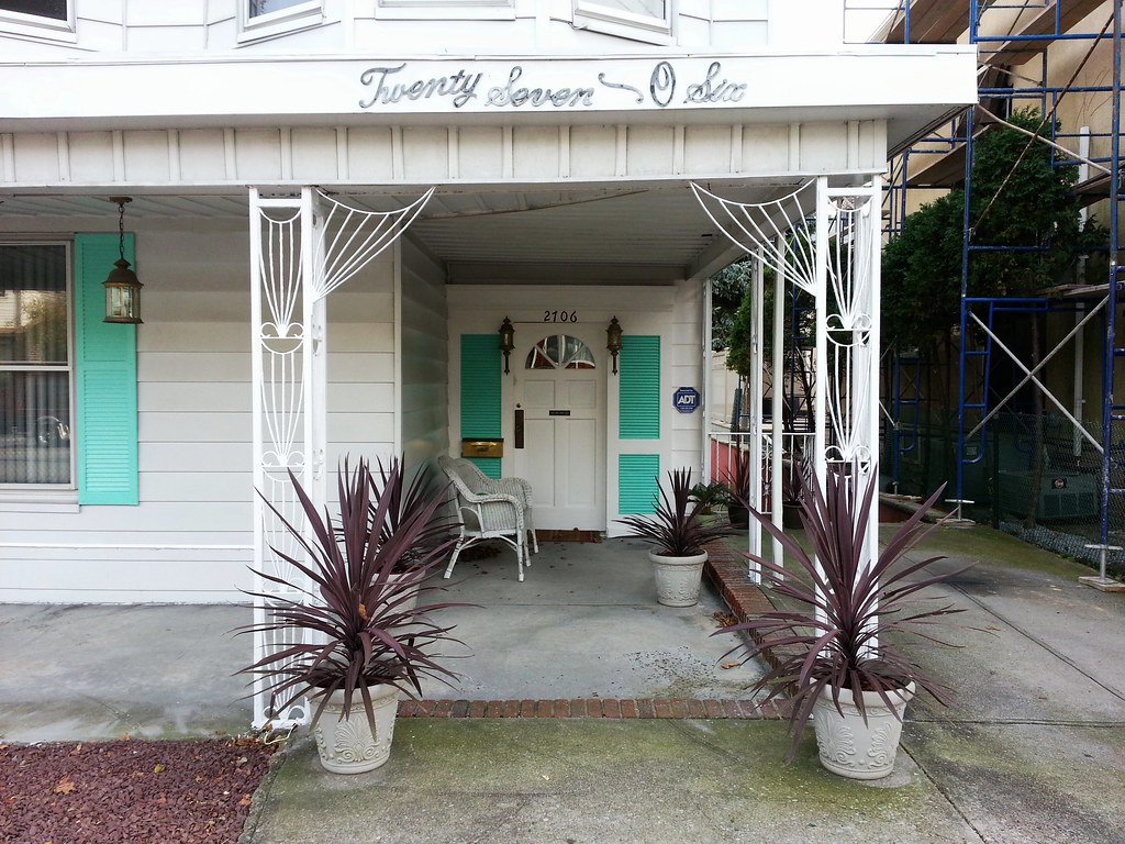
If you glance at a map of Sheepshead Bay, Brooklyn, you'll notice that Jerome Avenue appears to exist only between Sheepshead Bay Road on the west and East 23rd Street on the east. So why is there a Jerome Avenue address here on East 28th Street?
It's because Jerome Avenue existed long before the current street grid, and it once extended farther east than it does today. This is clearly apparent when you look at an aerial image: following the road's trajectory east from East 23rd Street, you'll notice a string of mid-block diagonal walls and fence lines that trace its former right-of-way. But when this eastern section of Jerome Avenue was wiped out some years ago, a tiny piece of it was preserved as a driveway east of East 28th Street because there's a single house here that once fronted on Jerome Avenue and is not accessible from any of the other surrounding streets. It would be stranded in the middle of the block if it weren't for this little surviving stretch of Jerome Avenue connecting it to East 28th Street. And so the house has managed to maintain its now-mysterious-seeming address of yore on an unsigned, gated-off remnant of the bygone thoroughfare that once flowed past its walls.
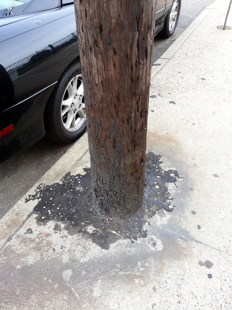
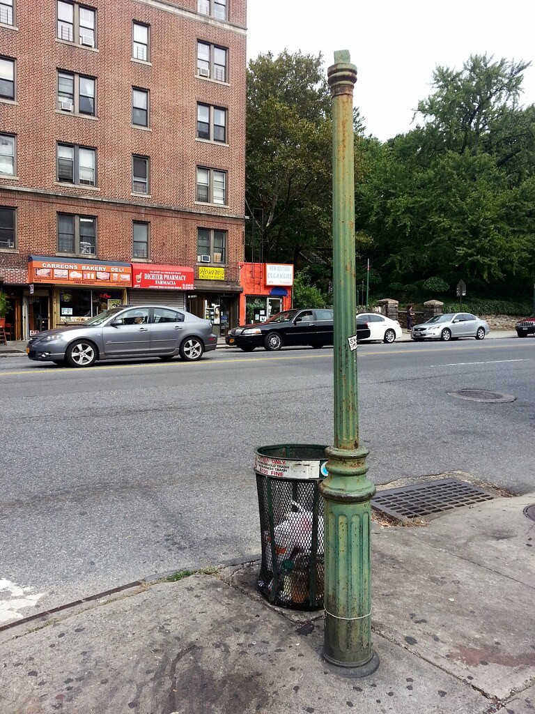
According to Kevin Walsh (scroll down a bit), this is one of only two surviving 19th-century gas street-lamp posts in the city. (The other one, which we've already visited, is on Patchin Place in Greenwich Village.)
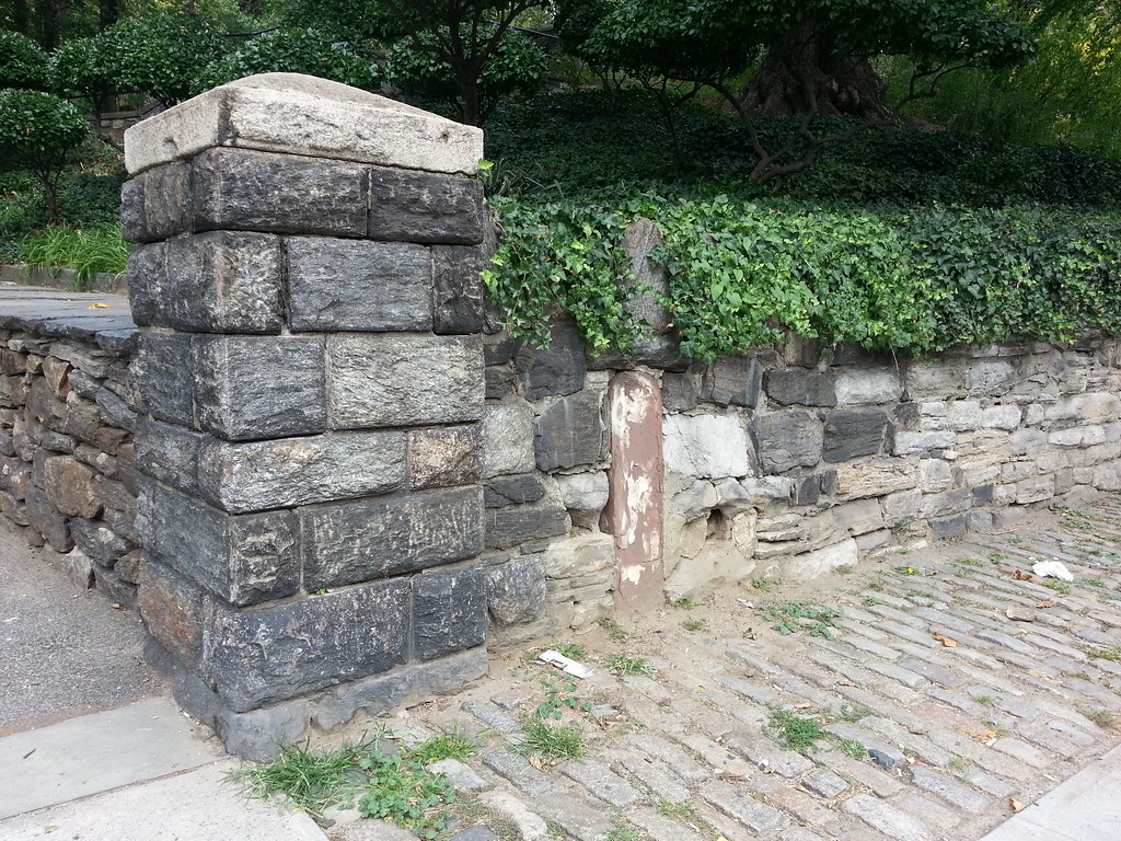
The skinny brown thing embedded in the wall is an old milestone, probably dating from 1813. It once stood a couple of blocks away on the Kingsbridge Road (today's Broadway), just south of what is now 204th Street, where it informed travelers that they were "12 Miles from N. York", that distance having been measured from City Hall. When the Kingsbridge Road was widened sometime in the latter half of the 1800s, the road workers tossed out the old milestone. It was rescued by William B. Isham, who had it built into the retaining wall beside the entrance to what was then his estate and is now Isham Park.
You can see some cool old photos of the stone and the wall here. (The linked page claims that the stone was originally an 18th-century Post Road mile marker, but that seems quite unlikely. Richard J. Koke, who authored an extensive study of the city's milestones in 1950, had concluded by 1964 that the stone was not that old.)
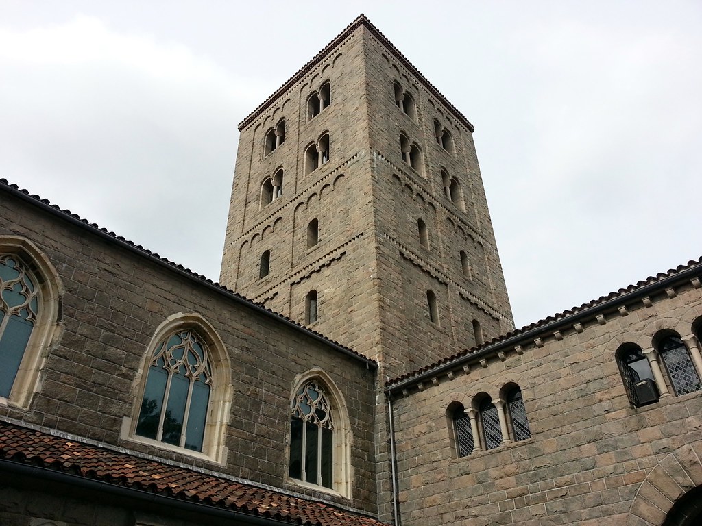
From The Metropolitan Museum of Art's website:
The Cloisters museum and gardens, which opened to the public in 1938, is the branch of The Metropolitan Museum of Art devoted to the art and architecture of medieval Europe. Located in Fort Tryon Park in northern Manhattan, on a spectacular four-acre lot overlooking the Hudson River, the modern museum building is not a copy of any specific medieval structure but is rather an ensemble informed by a selection of historical precedents, with a deliberate combination of ecclesiastical and secular spaces arranged in chronological order. Elements from medieval cloisters—Saint-Michel-de-Cuxa, Saint-Guilhem-le-Désert, Trie-sur-Baïse, Froville, and elements once thought to have come from Bonnefont-en-Comminges—and from other sites in Europe have been incorporated into the fabric of the building.
Three of the reconstructed cloisters feature gardens planted according to horticultural information found in medieval treatises and poetry, garden documents and herbals, and medieval works of art such as tapestries, stained-glass windows, and column capitals. Approximately two thousand works of art from medieval Europe, largely dating from the twelfth through the fifteenth century and including exquisite illuminated manuscripts, stained glass, metalwork, enamels, ivories, and tapestries, are exhibited in this unique context.
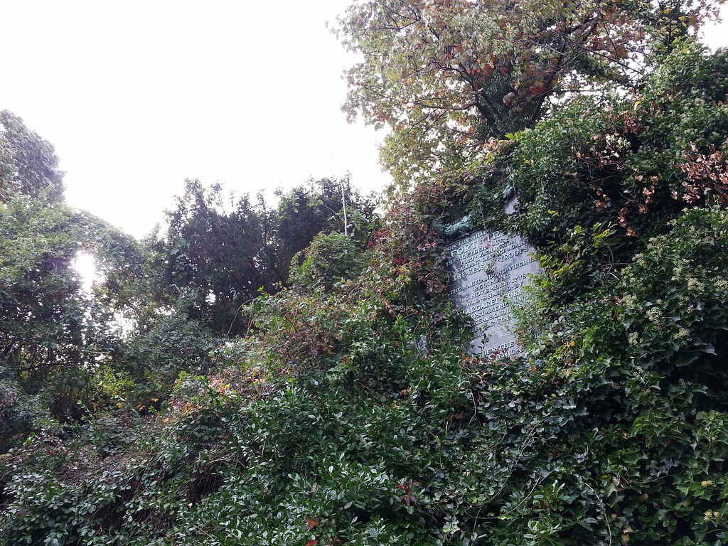
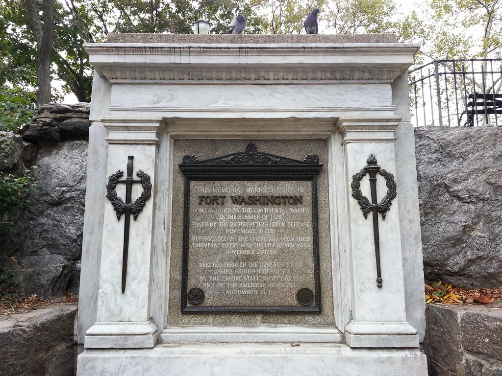
In 1909, C.K.G. Billings (he of the horse-mounted dinner party) funded the erection of this massive plaque on his property, on the former site of Fort Tryon in what is now Fort Tryon Park, to commemorate the Revolutionary Battle of Fort Washington and specifically the efforts and sacrifice of Margaret Corbin, who, according to the plaque, was "the first American woman to take a soldier's part in the War for Liberty". As you may recall, Corbin Place in Sheepshead Bay was officially redesignated in Mrs. Corbin's honor a few years ago after the brouhaha over the involvement of Austin Corbin (the street's original eponym) in the fictional-but-widely-believed-to-be-real American Society for the Suppression of the Jews.
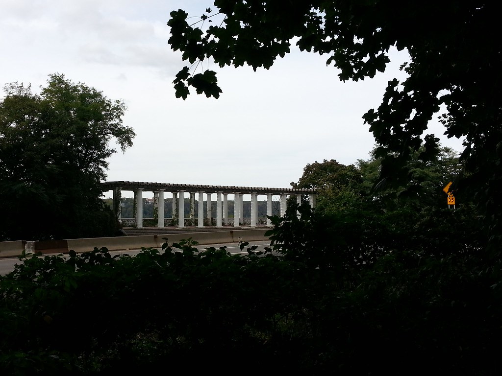
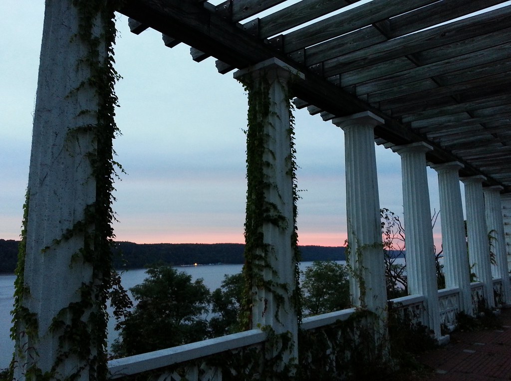
This neoclassical roadside shelter at Inspiration Point on the Hudson River was "built in 1925 as a destination point for promenaders and pleasure drivers." Here's a photo from its early days, when it had a lower level with restrooms open to the public.
Not surprisingly, this scenic area was apparently once a popular lovers' lane: a 1920 NY Times article described Inspiration Point as "a mecca for automobile 'spooners' " and reported on one magistrate's attempt to crack down on the practice by instituting ten-day jail sentences for those caught in the act.
The roadside shelter is no longer accessible from the road; it can only be reached from the recreational path running beside the Henry Hudson Parkway. It's also not much of a shelter anymore, as its roof was replaced with an open, arbor-like structure during a much-needed restoration in the 1990s.
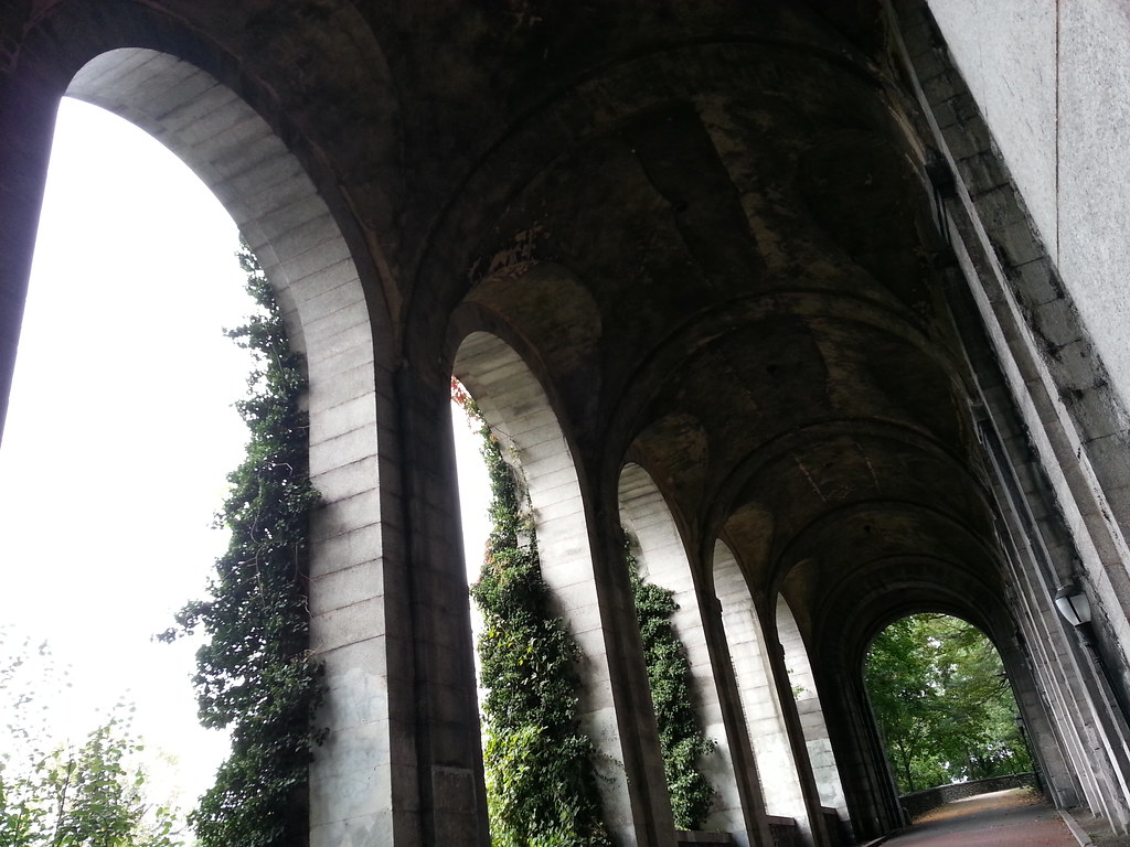
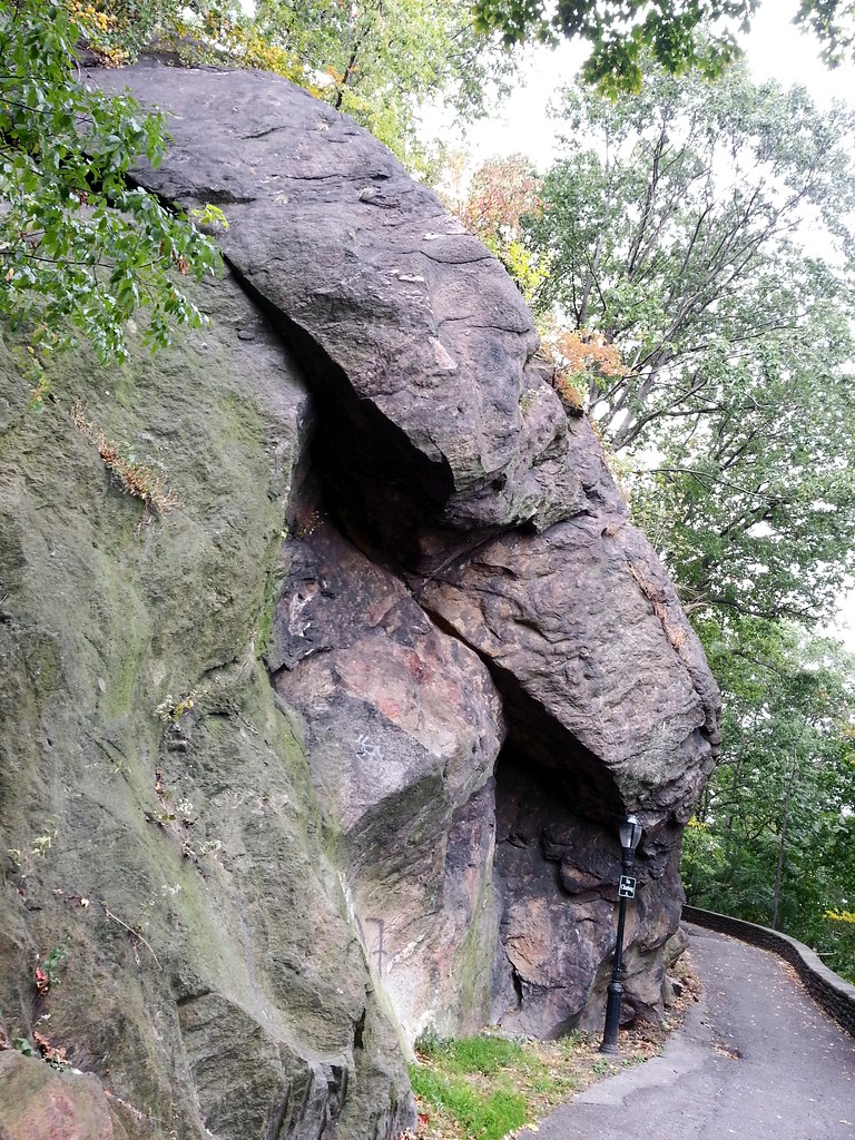
Here in Fort Tryon Park stands a colossal remnant of the old Billings estate, this "strange, giant stone gallery that resembles an ancient temple lost in the rain forest" on top of which we gazed out at the George Washington Bridge and the New Jersey Palisades last April.

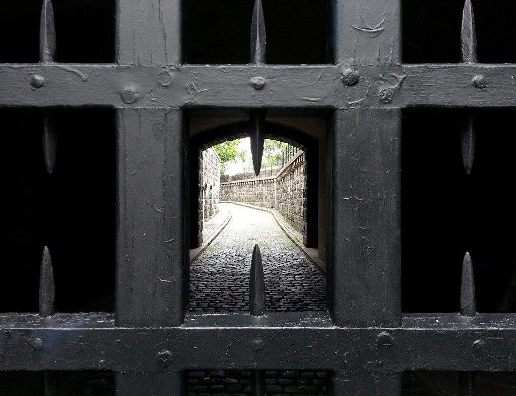
This was once the entrance to the winding driveway — now a pedestrian path — that passes through the stone arches seen in the previous photo on its way up the steep slope toward the site of the long-gone Billings mansion in what is now Fort Tryon Park. Here's a photo of the mansion and driveway from around 1910.
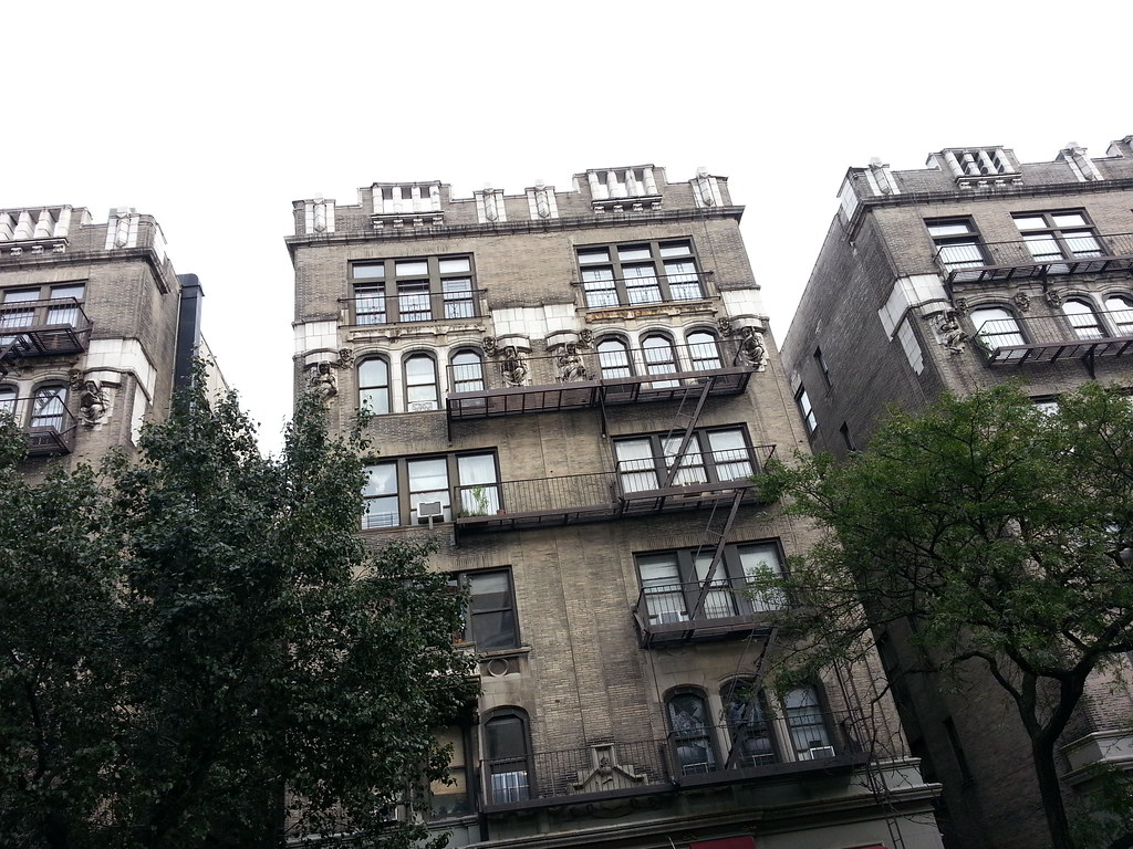
Here's a closer look at the figures on the building.
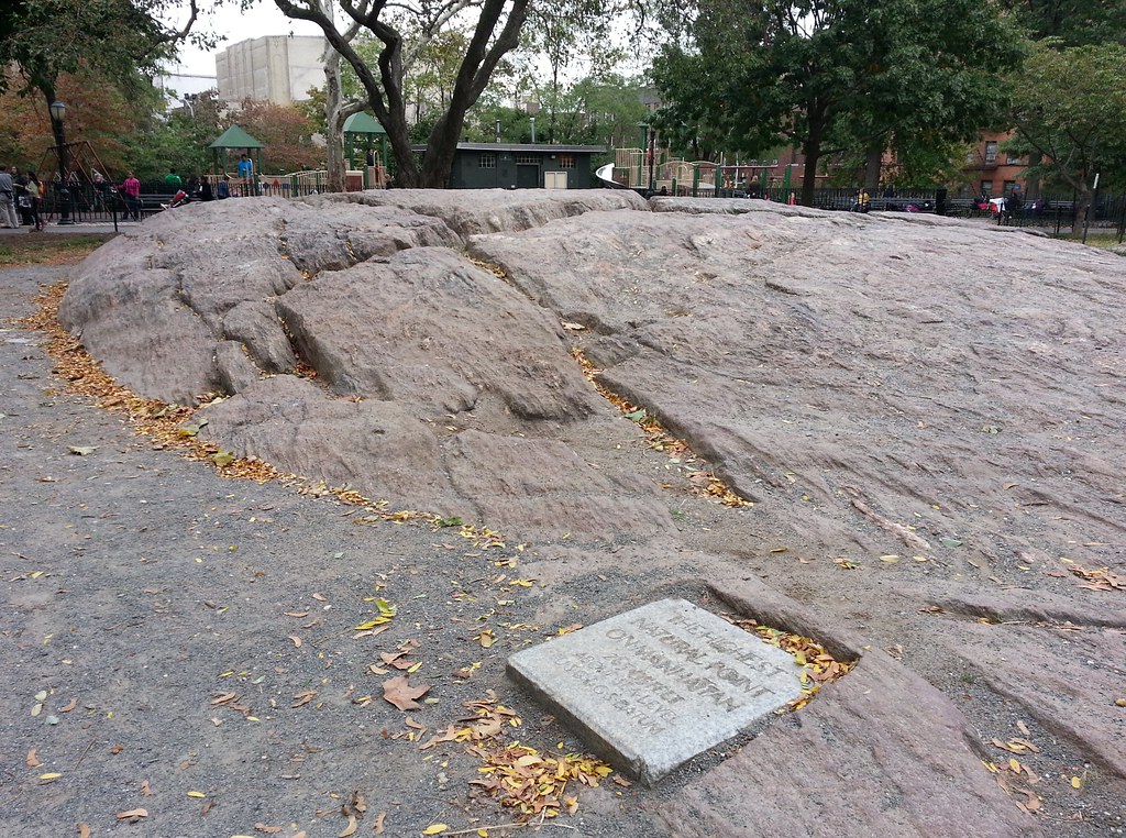
At 265.05 feet above sea level, the top of this rock mound is the loftiest peak in all of Manhattan.
In 1998, two daring adventurers set out to climb the high points of all five boroughs in a mere five days. From their account of Day 1:
Heading south on Fort Washington Avenue, we pass the prophetically named Hilltop Pharmacy and run smack into lovely Bennett Park, a pocket of green surrounded by odd, Tudor-style apartment buildings. We turn left onto Pinehurst Avenue and, with growing excitement, we scan the 1.8-acre park. We spot an outcrop of reddish rock rising gently perhaps three feet from the ground. On it, a granite plaque from the United States Coast and Geodetic Survey reads: ''The Highest Natural Point on Manhattan: 265.05 Feet Above Sea Level. USC & GS Datum.''
Eureka. Scrambling to the top of the rock, we breathe in what seems like thinner air and caress the summit's grainy surface. It's an exhilarating feeling. After we've hopped down and are resting on a park bench, we notice several toddlers and a pigeon summiting after us.

Here in Bennett Park, this replica of a Revolutionary War cannon sits atop a stone outline denoting the location of the walls of old Fort Washington.
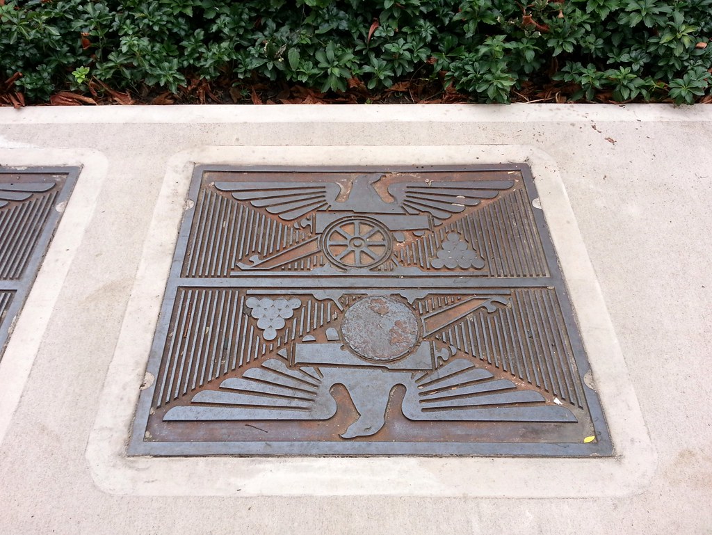
Across the street from Bennett Park, Hudson View Gardens celebrates its proximity to the former site of Fort Washington with these vaguely fascist-looking Revolutionary War-themed manhole covers.
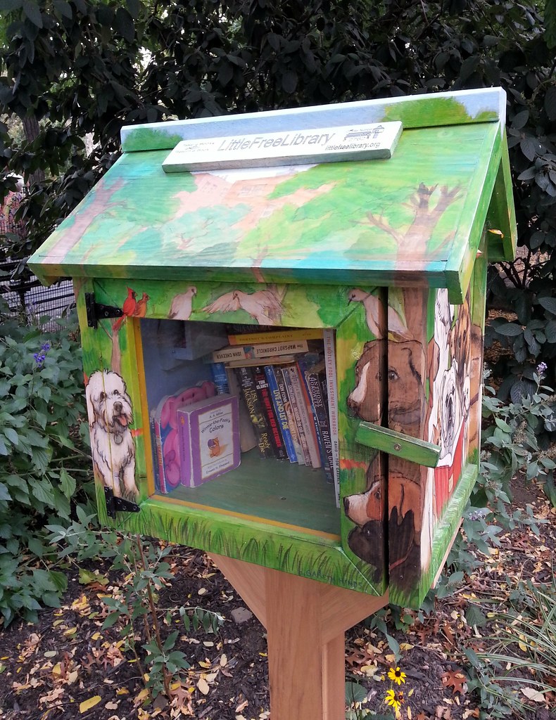
A Little Free Library — here's a closer look at its contents.
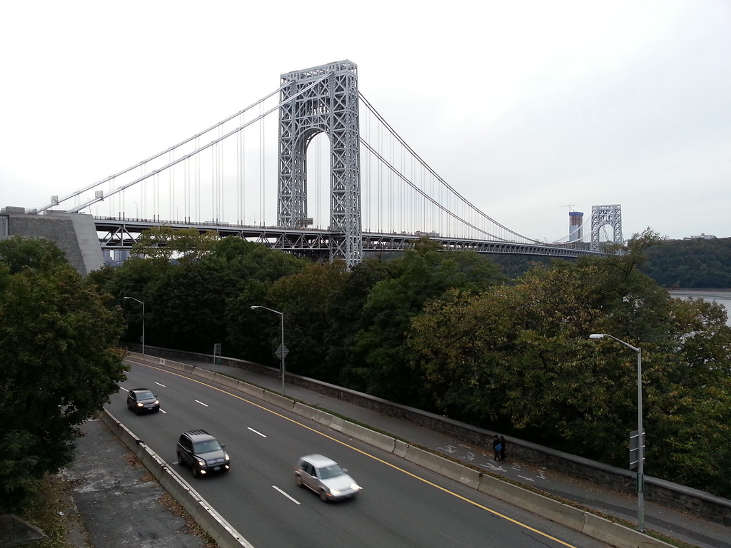
Referred to by Le Corbusier as "blessed. . . . the only seat of grace in the disordered city", the GW was once the world's longest suspension bridge, with a main span almost twice the length of the previous record-holder's. It lost that title long ago, but it has since earned a new one: it's now, according to the Port Authority, the world's busiest bridge (in terms of vehicle traffic). Under construction just to the left of the Jersey-side tower in Fort Lee is the first of two 47-story residential high-rises that, speaking of superlatives, will be the tallest buildings in Bergen County.
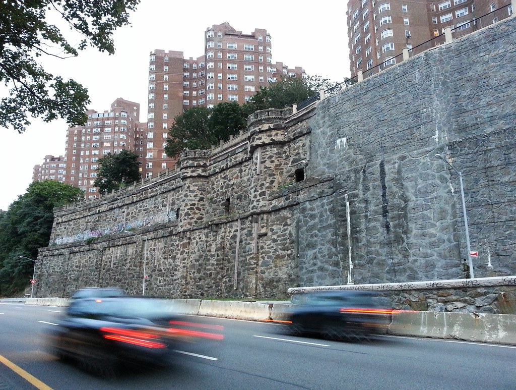
Just beyond the George Washington Bridge, the gargantuan retaining wall of the co-op Castle Village was reconstructed in 2007 after its astonishing collapse in 2005. It was erected around 1909 by Charles Paterno, who perched his castellated mansion and extensive grounds at the top.
The co-op rebuilt the wall with concrete panels made to imitate real stone. It is hardly convincing, but a noble effort nonetheless. Gerald Fingerhut, the co-op's board president, recognizes its shortcomings, but says "the reconstruction was $26 million we didn't have — we spent several hundred thousand to make it look better, and we can’t even see the wall."
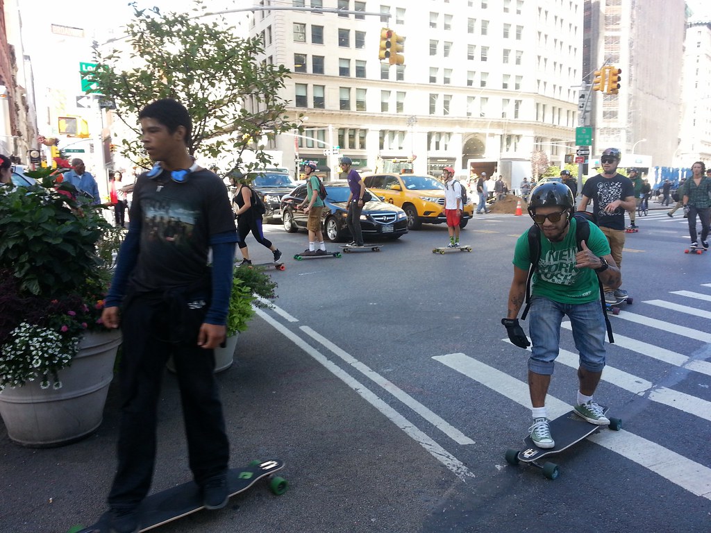
An 8-mile skateboard race through traffic down Broadway. Watch this hilarious Benny-Hillified video of the NYPD trying to stop the skaters.

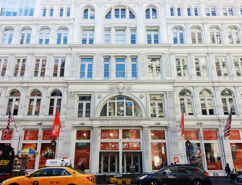
Situated on 23rd Street in what used to be the Ladies' Mile shopping district ("a nine-block-long stretch of architectural grandeur that once epitomized elegance in Manhattan"), this building, whose central section dates back to 1878, was originally the Stern Brothers dry goods store. In the mid-1980s, it was converted into office space and a showroom for the Hasbro toy company, which blocked off its first-floor windows to keep passersby from stealing glances at the next season's products. During the Hasbro era, the building also appeared in the movie Big as the home of the toy company where Tom Hanks's character worked.
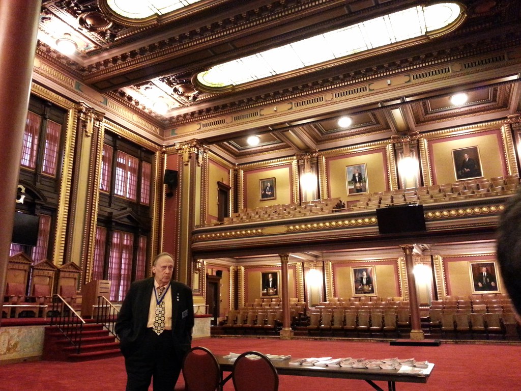
Magnificently renovated by the Grand Lodge of New York over the course of a decade in the 1980s and '90s, Masonic Hall on West 24th Street, with its "dozen stately chambers with a dozen architectural themes, where visitors travel from the Ile de la Cite to the Acropolis to the Valley of the Kings in the time it takes to ride an elevator", is open to the public for free tours on a regular basis. The is the Grand Lodge Room; you can see a few of my shots of other meeting rooms here, and you can see many more photos from two other visitors here and here.
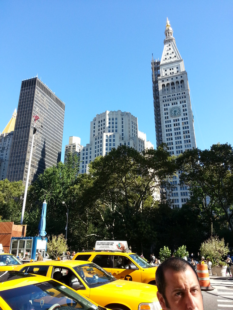
Modeled after St. Mark's Campanile in Venice, the Met Life Tower (at right) was the world's tallest building from 1909 to 1913. Notice the scaffolding on the north side; the tower is currently being converted into a hotel.
The odd-looking stump of a building to its left was originally designed to be a soaring, 80- to 100-floor skyscraper that would return the title of World's Tallest Building to the Metropolitan Life Insurance Company, but those plans faltered after the stock market crash of 1929. The 28-story structure that exists today is essentially just the base of the skyscraper that never was.
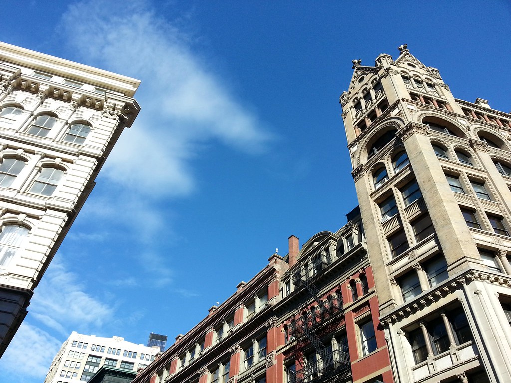
At right is the M(a)cIntyre Building, which the AIA Guide to New York City describes as "unspeakable eclectic: a murmuration of Byzantine columns, Romanesque arches, Gothic finials and crockets — the designer used the whole arsenal of history in one shot." More photos here.

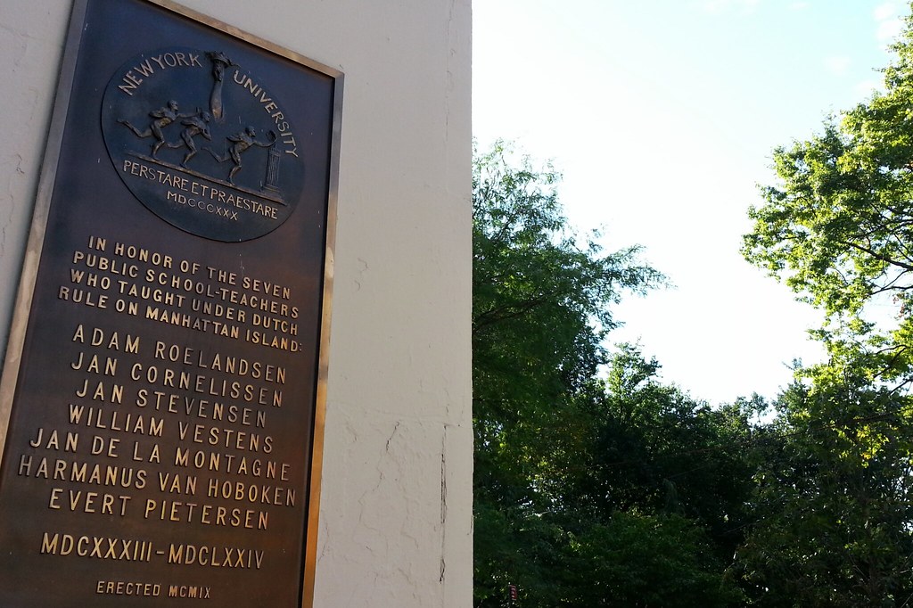
A tribute to "seven men [who] were among the first public school teachers in North America"

Until two years ago or so, this little stone column in the lobby of 2 Fifth Avenue, an apartment building by Washington Square Park, had a tall glass tube mounted atop it, forming an odd-looking, enigmatic fountain that reportedly flowed (on the occasions that it actually did flow) with the waters of the long-buried Minetta Brook.
Minetta Brook (also called Minetta Creek) was originally an aboveground waterway that ran through Greenwich Village on its way to the Hudson River (map). It was eventually covered over in the 19th century and incorporated into the city's sewer system. No one is sure exactly where the various sources that once fed the brook have now been routed (scroll down to the last section), or if they even still exist, but there have long been reports of flowing water being discovered during building excavations in the area, and of water seeping into nearby basements.
Reasons for the demise of the fountain above vary from source to source. Some say it was taken down during renovations and never reassembled. One doorman in the building told me it had dried up long ago, while another said it was so loud that the people upstairs complained.
2 Fifth Avenue wasn't the only building to pay tribute to the historical waterway with a fountain. The apartment hotel that once stood at 33 Washington Square West also had a supposedly Minetta-fed fountain in its lobby, sculpted by the same artist who carved Mount Rushmore. The dedication ceremony of this fountain in 1930 was apparently a big enough deal to be broadcast nationally over the radio.
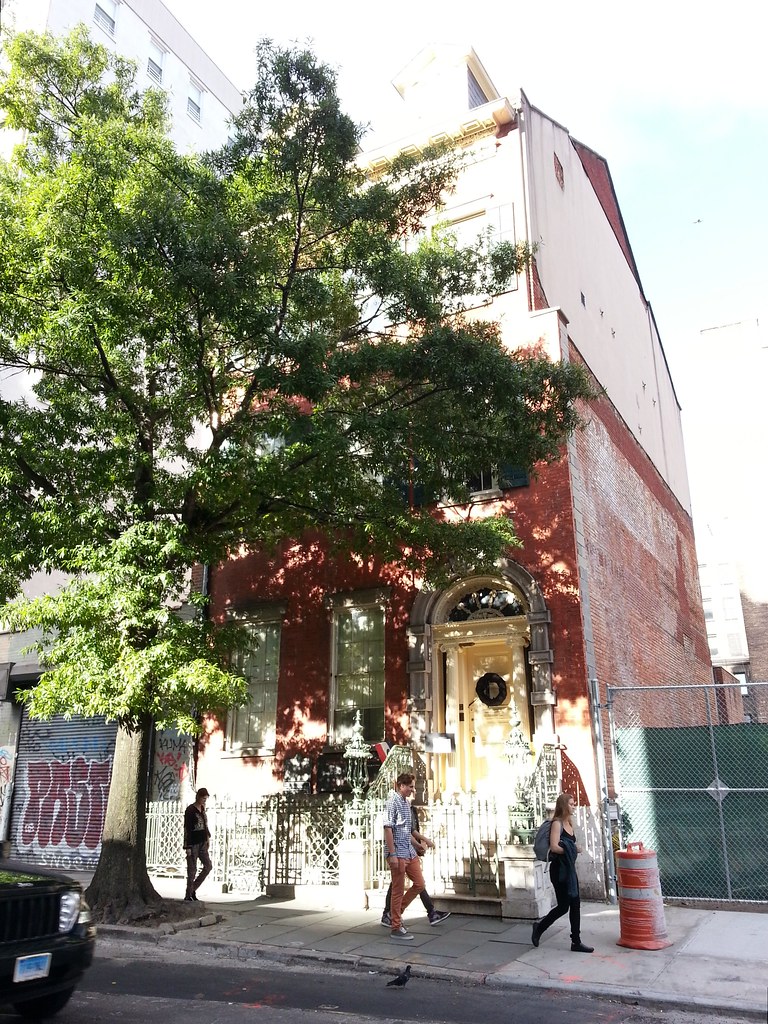
It doesn't look like much in this crummy photo, but this house is "the only nineteenth-century family home in New York City preserved intact — both inside and out." You can see some pictures of the interior here.
The New York Marble Cemetery — and it's open this time!

Mr. Quackenbos boasts perhaps the second-greatest name on the burial register of the New York City Marble Cemetery (not to be confused with the similarly named New York Marble Cemetery featured in the previous two photos), although the competition is fierce: Balthazar Andronicus Chesebrough, anyone? The best name, on the other hand, indisputably belongs to...
Ron Britt bought this 1971 Dodge Travco as a companion for the (now deceased?) "Free Willie" Nelson, a 1973 Dodge Mahal that he had "painted to resemble an orca whale, [with] a sound system that alternates Willie Nelson tunes with whale mating calls." Here are some more photos of Old Flat Top, and be sure to check out Mr. Britt's answers to the ten most frequently asked questions about the vehicle.

